ACKNOWLEDGMENT: Alby's Voyage is promoted by the Pacific Soaring Council(PASCO), and encouraged by the Soaring Society of America (SSA). PASCO represents about 400 glider pilots of Northern California and Nevada. The SSA represents about 12,000 U.S. glider pilots. Like Alby, both organizations foster and encourage all forms of soaring.


Alby's Progress

Map Legend

___ Successful Legs

___ Attempts

___ Proposed legs

___ Trip "by glider" to NY


Click, hold and move the mouse to move the map.

Point hand's finger, click on markers to read airport information.

Point hand's finger, click on path legs to read flight information.

Click on Sat (bottom left) to see aerial picture, enlarge to see airport.

Click on "View Larger Map" above to see full screen .


latest news


11/10/2017 - Sarah Arnold and Karl Striedieck fly the ridge, take one thermal to climb to just under cloud base and fly straight with no turns to Harris Hill, NY. Pins no. 32 and 33. Trafford Doherty, Director of the National Soaring Museum takes Alby in his care. Alby has now completed his Voyage.

8/5/2017 – Shane Neitzey took Alby from Front Royal to Eagle Field with a spectacular ridge flight – plus some thermals. See the flight on the OLC. With his flight Shane gained Pin No. 31.

Alby is now in the capable hands of Karl Striedieck who will make the final leg to Elmira, NY venue of the National Soaring Museum. This last leg is tricky but Karl is confident he can make it, with the best period for the attempt in October.

8/4/2017 – Dave Reilly flew Alby from Culpeper to Front Royal, completing his leg and earning Pin No.30.

7/16/2017 – Alby is at Culpeper airport, taken there by Dave Reilly who made it almost to Front Royal, but was 20 miles short when he decided to go back a little and land safely at Culpeper. He wants to try again soon.

6/3/2017 – Mamad Takallu flies his ASW-27 from Garner to Merlin, earning Pin no. 29 with a powerful straightforward flight.

7/17/2016 – Eric Lambert after almost one year abandons dreams of making a pure glider flights, starts the engine and motor all the way from Currituck to near Garner.

9/17/2015 - Eric Lambert flies Alby from First Flight to Currituck using the engine of his motorized Grob.

9/14/2015 - Alby arrives at First Flight, Kitty Hawk, NC!

Heartfelt congratulations to Alby pilot Eric Lambert, who found reliable lift on a blue day to get Alby safely to Kitty Hawk, for a well-deserved rest. Eric's notes on the flight are found in more detail below.

Briefly, he said, "I will return to First Flight in the morning and plan to meet with Karen Warlitner, the Executive Director of the First Flight Foundation, for a photo-op. We would like to have a photo of Alby next to the Wright Flyer. On Thursday and through the weekend, we hope to take advantage of this spell of good weather to fly Alby north."

8/31/2015 - Alby flew Sunday from Chesapeake, VA to Currituck , NC with Albypilot Eric Lambert in his motorized Grob 103.

Eric said that he found clouds to 5,000’ and lift up to 4 knots. He got low (1,700’) at the Academia facility (U.S. Training Center) but got back up to 4,000’ and then to Currituck. He said it was not difficult – sure I believe it, when the conditions are good! The flight of 25 miles required only two thermals, but it was one of the very few days that there were clouds and workable lift and no adverse winds. Clouds and lift disappeared soon after the landing.

Eric wants to spend four days of the long Labor Day weekend trying to fly with Alby the 33 miles from Currituck to First Flight Airport, a place that is so historically important for all aviators. Not an easy thing to do since near the coast the weather is not favorable to soaring in general, and in this case in particular the glider has to fly for several miles directly above water.


TALES OF THE FLIGHTS


Alby Flight No. 65 Pin No. 32 and 33 - Karl Striedieck and Sarah Arnold 11/10/2017


Alby at the Museum!

Departing from Eagle Field on November 10, 2017, Karl Striedieck, along with Sarah Arnold of Chilhowee Gliderport, Tennessee, flew Alby to the National Soaring Museum at Harris Hill.

Karl was at the controls for an auto-tow launch into the ridge lift 150 feet above the runway. Then Sarah took the controls, while Karl and Alby relaxed and enjoyed the ride. Though the temperature at altitude was 0-degrees Fahrenheit, the flight was an exceptional soul-warming experience. 

“Cloud streets were pointed straight upwind, from Williamsport to Buffalo. We would run up a cloud street pulling and zig-zagging through the strong lift until it ran out or converged with a more northerly street, then jog right, diving through the sink, to pick up the next one and turn upwind under that street to do the same thing over again,” Sarah describes, adding, “We flew the whole flight without a map or GPS – Karl knew the way by heart. He just kept telling me which way we were headed, and after a while we could see the valley near Elmira off in the distance.”

Sarah and Karl realized this flight was both personally and historically special. Sarah, reflecting on her own aviation odyssey, felt a deep gratitude for the journey which brought her to that perfect flight. (No doubt, Alby felt a similar gratitude to the soaring people who carried him for thousands of miles, culminating with this cloud street flight.)

Alby, Sarah Arnold and Karl Striedieck arrive at Harris Hill
November 10, 2017
Note the cloud streets, the ice on the canopy and the horizontal windsock
Their 100-mile, straight- line flight was remarkably akin to an albatross’ type of dynamic soaring. “Actually, we thought we could hear Alby coaching us as we soared the entire distance: ‘Don’t turn, don’t turn, yah yah!!’,” smiles Karl. Upon reaching Harris Hill, Karl took the controls once again and flew the pattern, and the nearly-frozen threesome landed at Harris Hill in winds gusting to 28 mph. Alby was home.

        “This dream of Sergio’s and PASCO of a man-made symbol of flight making a voyage across the continent took me back to my childhood when my father read Paddle to the Sea to us,” reflects Karl.” We were captivated by the native boy’s ambition to send his hand-carved model canoe from Lake Nipigon to the Atlantic, and all the impediments and hazards that befell it.”

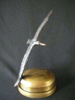
And so it was with Alby and the soaring pilots - they overcame the obstacles of terrain, weather patterns, and scheduling conflicts all the way across the country. Now, nine years after Alby came to life, Alby is a symbol of success at the National Soaring Museum, and will continue to inspire those who take note of this diminutive bronze albatross and its historical flight.

Trafford Doherty, Director of the Soaring Museum,
Sarah and Karl welcome Alby home

—end—

Alby Flight No. 64 Pin No. 31 - Shane Neitzey 8/5/2017


Alby and Shane at Skyline Soaring Club, Front Royal, VA
Saturday August 5, 2017 turned out to be a super fun, dynamic and challenging day. I launched at about 09:30 straight into wave.
Above clouds on the way to Eagle Field, PA
via Cumberland, MD
Made it 60 miles upwind to Cumberland MD, then flew the PA ridge system up to Karl Striedieck’s ridge top gliderport called Eagle Field. I did a few extra OLC miles before reaching the airport.


www.onlinecontest.org/olc-2.0/gliding/flightinfo.html?flightId=-1258000070 
Return flight at https://www.onlinecontest.org/olc-2.0/gliding/flightinfo.html?flightId=-1257830192

Alby handoff to Karl Striedieck
Karl was holding a winch clinic but I was granted permission to land. I presented Alby, then was offered to stay for a party and spend the night.

Winch out of Eagle Field, PA
Darn tempting, but I was also offered to be winched right out for a flight back home. Humm, decisions, decisions, I did not plan to re-light, but what the heck, it was still early. My time on ground was about 20 minutes before being catapulted up 1000’ releasing right into ridge lift.


The straight line measured distance from Front Royal to Eagle Field is 132sm. 4h 06’ up and 2h 55’ back, again via Cumberland, totaling 590km OLC round trip. Still have a lot to learn but, Holy Moly, it sure felt good.

On Evetts facing the Wall to transition onto Tussy
Many thanks to the Skyline duty crew Mike Peterson, Vern Kline and Jonathan Elie. And a big thank you to duty instructor George Hazelrigg for being willing to come get me. That would have been a 8+ hour drive round trip.

 P.S.
The ridge system and farmland in PA make it a soaring wonderland. And the people too; like Chris & Lianne Groshel (& Piper), Fred Winter, Karl, Peppi, Haven and many more.

Regards,

Shane Neitzey, XZ

Alby Flights No. 62 and 63 Pin No. 30 - Dave Reilly 8/4/2017

The date was June 3rd when Alby, flown by Tidewater Soaring's pilot Matt Takallu, arrived at Merlin Soaring, our small club located just west of Richmond VA. He was not unfamiliar with us since I'd crewed and he'd flown with our President Eric Lambert, on the final leg into Kitty Hawk, North Carolina back in September of 2015. So getting Alby to the ridge before fall had become our task.

Alby at Culpepper
On July 16th conditions looked promising. Winds were from the southeast, unusual for us, and with the weather forecasting program “XC Skies” looking overly-optimistic (Ha-Ha!) I decided this might be the day. So after consulting with Jim Garrison and Eric I decided to see if my LS8-18 and I could make it. My 12:30 tow to 3k went well, but with low cloud bases, my initial climb topped at just 3.5k and things did not seem promising. Pushing to the northwest though, I tapped some really strong lift a few miles from the field, climbed to over 4k and decided that was the sign I needed. Good energy lines got me across the James River and with some help from those ground-bound thermal-kick'n cars on route 64 the run to Louisa County airport was good. Not so good at Louisa though. The air was dead and I spent more time than I'd have liked digging out. Eventually though a complex of industrial buildings north of the airport got me to over 5k and the run northwest went pretty well. With Orange County and the town of Culpepper behind me, I got to within 20 miles of Front Royal airport site of “Skyline Soaring”. By this time though, it was late in the afternoon, the ridge was in a haze and the air was far less dynamic. I'm a flatlander. Attacking the ridge now? Not a good idea, so I eased the 10 miles or so back to Culpepper, VA airport, landed down, called up an aero tow from Merlin, chilled in the air conditioned FBO and contemplated my next Alby move.

Them'thar ridges!
I'd been watching the forecasts and on August 3rd things looked good for picking up at Culpepper and running to the ridge on Friday August 4. Knowing little about the ridges, I again called upon the experts. Shane Neitzey and Eric Lambert recommended a run to Luray and then a tail wind assisted run to Front Royal. That was the plan so having commandeered good-guy/instructor/tow pilot Paul Roberts to tow, we left Merlin headed for Culpepper at around 11:30. The flight went well. The problem? Cloud bases were at 4k or so and to me that did not bode well for crossing the ridge. Following the Alby rules, I left tow a few miles south of the airport and sniffed about, testing the air. There was good lift but with bases at something under 4k, it was not the time. So I sat down at Culpepper, talked thunderstorms with the FBO guys, grabbed a sandwich and consulted with Paul. By 2 o'clock the FBO reported bases at 4.5k and it was time to re-light. I left Paul and our Cessna 150/180 in a thermal at 2.7k, climbed to 3.5k and headed toward Luray. The clouds were working and my 4th climb took me to 5k and a good view of that tree covered unlandable ridge. With winds from the south, and 2 more climbs to 5k the ridge became no problem and the run to Luray no longer needed. Crossing the ridge had been THE issue and it was done! Now to Front Royal...and with my aging LX 7000 showing 8.5 miles, I relaxed and enjoyed the ride.

Alby at Skyline Soaring
Alby meets Skyline's Matthew
The air was good and much as I'd like to have explored a bit, I put down at Front Royal. After all, there was still the aero tow back to Merlin, Skyline Soaring was of course not operating but as it turned out I was greeted by Matthew, a Skyline Soaring member who helped with the roll-off, some water, and the re-staging. Thanks too go to FBO manager Reggie and his 2 border-collies for their cordialness.

Alby, Dave Reilly & Paul Roberts


The aero tow home went well and Paul and I were on the ground by 7pm. A long day, but a satisfying one. Alby was finally on the ridge and I knew Shane was hot to get him moving to Karl. What I did not know was that it would happen the very next day, with wave, a great run up, a winch-launch and a nice run back to Front Royal. I'm just pleased to have been one of the many, many pilots who helped to make this happen. Alby is now in highly respected hands and he will soon be home!

Dave Reilly

Alby Flight No. 61 Pin No. 29 - Mamad Takallu 6/3/2017

On Saturday, 6-03-2017, Alby was flown from Garner Field (3VA8) to Merlin Aerodrome (2VA3) by Mamad Takallu in an ASW27B. The original thinking was to do an out-and-return to Merlin but Alby didn’t want to leave the cockpit on its own from 3000 ft resulting in a full-stop landing at the home of the Merlin Soaring Association.

The weather was exceptionally good for this part of (South East) Virginia and at Tidewater Soaring (TSS) there were a lot of private gliders ready, in the queue, to be launched. Finally, at around 2 PM local time, Alby was towed to 2000 ft by a Pawnee 235.

Initially, climbs were around 2-4 knots and slower past 4000 ft. There was a steady North Westerly (head wind) of 10-20 kt into the course line, increasing with altitude. The flight was into the wind on a blue (CAVU) day, overall easy and uneventful. The flight duration from take-off was a little over 2 hours and the time for the 140 km task was about 1.5 hours.

Upon arrival at Merlin, several members of MSA were still on a cross country task and Eric Lambert, who himself flew Alby to and from the First Flight Airport, was instructing in a SGS-2-33. So, we decided NOT to take a tow for return, when Eric suggested that we should celebrate this flight with the rest of MSA members.

Many Thanks go to Marita Rae, a long time TSS member and club CFIG, who graciously “schleppt” the 27 trailer with her trusty van on a more than 6-hour round trip to Merlin.

Attached are the links to the OLC flight trace, Spot Tracker traces, and a group photo with the new guardians of Alby at Merlin.


http://www.onlinecontest.org/olc-2.0/gliding/flightinfo.html?dsId=5798883
http://www.ssa.org/sailplanetracker/default.asp
http://share.findmespot.com/shared/faces/viewspots.jsp glId=0q60cECRtItYHsyrjlnx6CFaMa4qiXyuF

C U @ 3VA8,
MAT

Alby Flight No. 59 Pin No. 28 - Eric Lambert 9/14/2015


Alby flew today from Currituck, NC to First Flight, Kitty Hawk, NC

The cold front was predicted to pass over Currituck on Sunday [August, 13]. I drove to the airport, as it was forecast to be good at the end of the day. As it turned out,  I spent the whole day cleaning and waxing the glider so it would look good at First Flight. The clouds did lift to above 5,000’ at 5:00 PM however the >15knot  crosswind prevented me from taking off. A long drive back to Richmond with regrets I did not give it a try, the sky looked great at 6:00pm, but the wind was still howling. I arrived home after 10:00pm.

Nearly there, looking south toward Kill Devil Hills and the Wright Memorial at First Flight Airport
Up again Monday morning and on the road by 7:00 AM, the forecast was for 3,000’ at Currituck but no clouds; it was going to be a blue day. I also had a crew, David Reilly, who drove down a little later. Still a 10 knot crosswind but the take-off was fine with a quick thermal assisted climb to 3,000’. Shut down the engine, then due to drift downwind during the start, a quick flight back over the airport to start the flight from northwest of the airport.

Alby and Eric Lambert at Kitty Hawk


Not a hint of a cloud in the sky. A few miles south of Currituck I took a thermal that gave me 150’ above glide for First Flight; from then on it was all lift very little sink. I left the peninsula with 2000’ above glideslope for Kitty Hawk.


Alby landed at Kitty Hawk after first going for a trip over the Atlantic Ocean; approach to the airport was from the east.

A pure Glider Flight, engine only used for take-off. The flight is on OLC and 2 photographs are attached.

Alby has landed.

Eric Lambert


P.S.

[Ed: Eric provided this timeline summary of his efforts to help Alby get to Kitty Hawk. After his first commitment 5 years ago, a wait, months of watchful planning, diligent efforts, and then success.]


Now we have made it I can put some of the details together. But for now this is the timeline I have:

March 2010        Commit to take Alby from Merlin to Newcastle VA.
April 2014          Email from Albymaster proposing I take the leg Merlin to Eagles Nest VA.
May 2014           Alby arrives at Garner Field.
April 2015          Request by Albymaster to support the flight from Garner to Kitty Hawk using the Grob 103SL.
April 27th           Alby flight to Chesapeake VA in Grob 103 from Garner field, aero-tow launch. Mat and Eric as pilots.
April 28th          Attempt to fly Chesapeake to Currituck. Conditions were not suitable. Pilots: Mat and Eric.

Now I have a period of personal and business commitments including: Consulting work in Nebraska, a wedding (not mine) a sailboat race, a 28 year tradition, and house guests. It did not help that when I could have found time the weather was not cooperating.

We did make use of a rainy day to drive down to Kitty Hawk and looks at all the possible landing fields on route.

August 28th       Together with a new commitment, attempted the Chesapeake to Currituck flight. No Go. Pilot: Eric.
August 29th       Attempted Chesapeake to Currituck. No Go, Pilot: Eric.
August 30th       Complete the Chesapeake to Currituck flight. Pilot: Eric. 
Glider returns to Chesapeake using power.
September 2nd   Attempted Currituck to First Flight. No Go. Pilot: Eric.
September 3rd    Attempted Currituck to First Flight No Go. Pilot: Eric.
September 11th  Attempted Currituck to First Flight. No Go. Local soaring ok; 3 ¼ hour flight but the clouds prevented flying to the south,
September 12th   Heavy rain.
September 13th   I made it out to the airport but the cold front did not pass through until late afternoon. Good looking cu’s but a very strong X wind. Waxing all day!
September 14th   A clear blue sky; not a cu. in sight, but the lift was good all the way to Kitty Hawk. We just had to be there on the right day!! Success. Pilot: Eric


Alby Flights No. 51 - Eric Lambert and Mamad Takallu 4/27/2015


Alby flew today from Tidewater (Garner Airport), VA to Suffolk Airport to Chesapeake Airport, VA with a total distance of 13+15 = 28 miles. 


Grob 103
The motorized Grob 103 C Twin III SL that did the successful flight to Chesapeake
As anticipated, it was not an easy flight. The main accomplishment was the crossing of the Great Dismal Swamp, a 10-mile soaring black hole centered on Lake Drummond. The weather was a little less than expected, but there were clouds and the initial climb was to 6,000’, a fact that did not repeat itself. The flight was made with a Grob 103c SL motorglider, the two Albypilots were Eric Lambert and Mamad Takallu. Eric’s wife Luana was crewing.


Left to right, Mamad Takallu and Eric Lambert
proudly showing Alby at Chesapeake Airport, VA


Alby Flight No. 50 Pin No. 27 - Heinz McArthur 5/25/2014

Alby continued his voyage yesterday from Crooked Creek, NC, to Garner Gliderport, VA, a course distance of 108 mi.
Prior to launch, we had a visit from a reporter with the Franklin Times, a local newspaper.  He took photos of the launch preparations and participated in our preflight discussions.  We look forward to a good Alby story in the next week or so.

I was assisted in my preparations by Ray Kleber (Col, USAF Ret, WW II/Korea/Vietnam vet, Master Pilot), and Frank Swett (Col, USA Ret, owner and master of Crooked Creek).  With this supporting cast, let me just say I was not lacking in supervision!

Col Kleber was the tow pilot.  Take off was at 12:40 pm, with a release from tow at 2000 ft.  The conditions were good, as forecast, with plenty of Cu's with bases around 6,500 ft.  I landed at Garner at 3:10 pm.  With those conditions, I should have had a better cross country speed but otherwise an enjoyable flight.
Mamad Takallu flew out of Garner to meet me, but we were not able to connect in the air.   Too bad I missed him, but Mamad made the best of it with a 355K flight recorded on OLC.
The folks at Garner were friendly and efficient, and had my glider ready to relaunch in short order.  I finished the paperwork and handed Alby over to Tidewater.  Photo attached of the auspicious occasion. 
I relaunched from Garner at 3:46 pm, and initially enjoyed nice Cu's and good lift in Va.  Heading back to the southwest, some high cirrus began to dampen things a bit, the lift began to weaken, and the skies ahead less inviting.  I opted for an easy landing at Halifax-Northampton Regional Airport, near Roanoke Rapids, NC.  I called Crooked Creek and Frank responded by flying the towplane over for an aero-retrieve.  A local pilot agreed to run my wing and we had an uneventful launch and 40 mi cross-country tow back to Crooked Creek.
I activated the Alby SPOT Messenger but appear to have made an error in placement or button pushing since no SPOT positions were recorded.  My apologies for that.  The flight log is available on OLC here:

Good luck to Tidewater Soaring and Alby on his next leg to First Flight Airport!

Heinz McArthur HM

Jenn Player, Tidewater Soaring Society President, receives Alby from Heinz McArthur


Frauke Elber, among other things Editor of the magazine of WSPA (Women Soaring Pilots Association) from Tidewater sends us this note:

“We are giving Alby a good nest to rest. Garner Gliderport is the Eastern most Gliderport in the Southeast of the US.

Frauke.”
 

Alby Flight No. 49 Pin No. 26 - Jake Alspaugh 5/13/2014

Flying Alby to Crooked Creek had a fair amount of stress involved. The day started with small clouds in our area and climbs to 5,500’. The north route looked better but I wanted to go south of Greensboro and Raleigh for more landing opportunities. It soon became apparent that only the north route would work. This late decision made getting around Greensboro seem like it took for ever.

Soon I started getting to 6 and 7 thousand and was approaching Raleigh. Moving to the south again I started seeing another blue hole. So north it was going to be. This route to the north introduces a glider pilot to a large reservoir and trees. I was staying high and with a good tail wind. Soon I made the general area of the Crooked Creek gliderport where I estimated Alby needed to rest for a while.

Charlie had given me a small hand-held GPS, but I could not make it pull up the satellites. I made a call to Crooked Creek Ground to see if they could help me locate the strip. This strip is in the flatlands and after a lot of conversation I concluded I must have overflown it by 10 miles. I put Raleigh in my ClearNav and asked Crooked Creek Ground how far they were from Raleigh.

Twenty-three miles was the answer but later I found they meant from down town, not the airport, which was 28 miles. Frank Swett decided he needed to get in the towplane and come up and find this lost Alby Express pilot. Thanks to Frank and all his help, Alby was soon on the ground at Crooked Creek. I do apologize for all the radio noise; I don't make a habit of this.

While I was approaching the landing, I was looking to the west to see how the clouds were holding up. They were thinning and this is never a good sign. It was about 3:30 and too early to give up, so I towed out for the trip back and hit fair lift and was at 7,000’ after a while. Charging off to the west with at least 15 knots head wind, I set out. After a while I started getting lower and this was about where the trees started. Soon I started thinking going west - maybe this was not such a good idea after all.

I spotted a small cloud over a rock quarry just upwind. The sink was very strong and held for a long time bringing me down to 2,800’. There was a field off to the right that I could make if this plan failed - this was the only field for miles. After a while I blundered into the lift and climbed back to 5,000’. One more thermal and I would make Burlington, but this was not in the cards and I had to move to the north more and put Person County A/P in the ClearNav. It said I had it by 500’. I made it by 50’ under pattern. Soon I was drinking free beer and waiting for my champion Bob Hills. These were two exciting flights, but a few less trees would have made it more comfortable.

I wish Alby a safe flight on into the beach. Thanks for all the help from Charles, Frank, and most of all Bob.

Alby Flight No. 48 Pin No. 25 - Tom Moore 9/9/2013


On Sunday Sept 9, 2013 I had the honor to pilot the 25th leg of the Alby voyage. The flight started at Bermuda High Soaring, near Lancaster, SC  and ended at Piedmont Soaring’s Bahnson Field, near Winston-Salem, NC.   Alby had arrived at Bermuda High Soaring on Friday Sept 7, 2013, having been delivered by Larry Travers from Carolina Soaring Association in Spartanburg, SC. The timing couldn’t have been better for a quick turnaround to the next stop. On Saturday, the day after Alby arrived, I had flown over 400 km, and it looked like that weather would continue to hold up through Sunday. After landing on Saturday I was approached by Jayne Reid, the co-owner of Bermuda High Soaring, about delivering Alby to Piedmont Soaring. I didn’t hesitate to volunteer. And Sunday would be the day. Along with Sunday having a good forecast, waiting would be chancy as the weather would be less and less likely to produce long distance cross country soaring days between now and Winter.

On Sunday I strapped Alby into the cargo area behind the seat and launched at 11:45am ET. By this time CUs were forming and developing into slightly more than wisps. I released at 2500 ft AGL just south of the field into a thermal and was able to climb under a CU to 3100 ft AGL.  I was actually pleasantly surprised with 3100 for this time of day in this time of the year.  The path to Bahnson Field was due north, and by the time I had passed Pageland Airport (which is 10 miles north of Bermuda High) I was reaching 3600 ft AGL and the CUs were much more developed. I had invited Jayne Reid to fly that day also, and she launched in her 18m DG800 (JX) around 12:30pm.  I was flying my 18m ASG29 (T4).

The terrain between Bermuda High Soaring and Bahnson Field was relatively flat. The 96 mile flight was all within the piedmont region of North and South Carolina with ground elevations ranging from 350 ft MSL to 800 ft MSL. The area development is mostly rural with a mixture of pastures, cultivated fields, planted pine timber, and natural forests. Landout locations were available (but not always plentiful) throughout the route in the form of farmers’ fields. As I passed north of Pageland I chose a path close to the eastern edge of the Charlotte airspace to make a roughly straight line to Bahnson Field.  I kept Anson County Airport which is 35 miles NNE of Bermuda High in mind as a bailout airport but stayed well to its west. By 12:50 pm I was 30 miles out of Bermuda High and 15 miles directly west of the Anson Co airport. The day was working well with cloud base around 4200ft AGL and thermal averages ranging around 3 to 4 kts with about an 8kt headwind. The next public airport I would come close to would be Rowan Co (Salisbury, NC) which was 41 miles to the north.

As I continued to fly northward my confidence level in completing the 96 mile trip to Bahnson was growing by the minute. Unfortunately it wasn’t going to be that easy. As I approached the Salisbury, NC airport I realized a high level shelf of cirrus clouds was ahead of me and appeared to be a solid coverage to the north.  There were clearly no CU’s under this broad coverage which I guessed extended 10- 15 miles to the east and west of my intended flight path.  On the eastern and western edges of this cloud coverage I could makeout CUs in the far distance.  I decided to continue north as far as possible utilizing the last few CUs ahead of me and try to work up enough altitude for a long final glide to Bahnson Field.  I reached the last CU about 4 miles north of the Salisbury airport with about 21 miles to go to Bahnson. I was able to climb to 4000 ft AGL with ClearNAV predicting a final glide arrival at Bahnson at a low 500 ft AGL.  I just needed a little more.

 I decided to play it safe – I really didn’t want to land out in a field “almost” making it to Bahnson – so I chose to fly to the west (90 degrees away from my course) to work around to some CUs that might give me a better altitude and position for my final glide.  As it worked out I found a CU with a working thermal about 5 miles to the west and slightly to the north.  Here, with an altitude of 4200 ft AGL I started what I thought might be my final glide to Bahnson field with a predicted arrival altitude of 1200 ft.  At this point life was good - confidence was back - I would make it.

I radioed to the Piedmont Soaring Club that I was 20 miles out, had final glide, and was delivering Alby.  I was immediately greeted by the friendly voices of the Piedmont Soaring Pilots who quickly offered locations of thermals that were still working under the cirrus cover.  At 10 miles out I picked up about 600 ft in a thermal which gave me plenty of margin to reach the field, circle to the north, and enter the pattern. Prior to landing I radioed Jayne (JX) to let her know I was at Bahnson but had flown the last 20 miles under cloud cover.  Jayne had flown a slightly easterly route over the Anson Co Airport and was holding around the Stanley Co Airport which was roughly halfway between Bermuda High and Bahnson.  I landed at Bahnson Field at 2:37 pm and was greeted by a very friendly group of pilots, students, and observers.  Thanks to Charles Cook, Craig Conrad, Bob Shields, Dalton Eberhart (the tow pilot) and others for making me feel at home.

After presenting Alby to Charles Cook, I called Frank Reid at Bermuda High and talked about options to get back. Jayne was reporting good soaring weather around Stanley Co, and the best option seemed to be a high aerotow  to the south. So I got back in my glider and at 3:15 pm was graciously towed several miles south and to a high enough altitude that I could reach sunny skies and workable CUs.  Once in the air I contacted Jayne and let her know my location. She was around Anson Co and reported good conditions. The still present cirrus overcast had grown to the southwest, and was hindering  a directly southern course back home. Diverting to the east towards Anson Co I stayed out of the eastern edge of the cirrus, made Anson Co, then had workable thermals for the remaining 35 miles to Bermuda High. The high tow and an 11 kt tailwind made the return trip quick, and I reached Bermuda High by 5:00 pm. What a great day!  

OLC flight: http://www.onlinecontest.org/olc-2.0/gliding/flightinfo.html?dsId=3376410


Alby flight No. 47 Pin No. 24 - Larry Traverse 9/6/2013


We received Alby on Fathers' Day, June 16. Fernando Silva and that rowdy crew he hangs out with, squeaked into Spartanburg. I think the words were" Whew". It had rained a lot before this but now it started raining every day. In two months we were 19 inches above normal.

Nobody flew for two months and we felt Alby had brought a curse. We had a priest fully immerse him in a baptismal font and on 7/24 I headed for Bermuda High. Thirty miles later I was on the ground at Union airport. MORE HOLY WATER. It finally stopped raining and on 9/6 I took a 2000’ tow and punched in Bermuda High.

Things went fairly well for about half the flight and I worked lift up to about 3800’. At Chester I had my last cumulus (with about 45-50 miles to go). When I crossed the river at Lancaster I was resigned to land at the airport but I messed around so long looking for lift, I couldn't make it. I had nothing but city to the North so I decided to continue East to some of the fields I could see.

I had about 25 miles to go and I hit every landfill, junkyard, and chicken house along the way. I was sure I was soon on the ground. The day was done and so was I. At 8 miles out my PDA said I was 500’ below glide. At 5 miles I hit a monster that sat me down in the seat and the rest is "I'll never do that again". Frank Reid was there to greet me and my advice to him was to get rid of Alby as soon as possible and I learned he left two days later.     

Larry Traverse (left) consigns Alby to Frank Reid in Bermuda High, SC

Alby flight No. 45 Pin No. 23 - Fernando Silva 6/16/2013

Fernando Silva, preparing for a long flight


FS and 6i ready to go
Alby was delivered!  Great team effort with Joe Flores handling communications, Dan Nugent and Michael Abell driving, and Mitch Deutsch and me flying. 

We assembled at 10:30 with 24 gallons of water each. We expected 5,000'+ cloud bases but it was evident that the dew points were very juicy!  

Delayed launch until 12:55 when cloud base reached 2,400' AGL.

Fernando with checklist

We hung around till 13:30 with cloud bases only at 3,200' AGL. Since we had a 9 knot tail wind we left flying in non-racing mode. It was evident that we could not go above the AHN class D so got permission to transit and got as low as 1,800' near Athens but climbed in about 2 knots which turned out to be the typical climb. 

Fernando ready to launch for Spartanburg

Aimed at Elberton next but deviated towards Anderson SC on a better street. Crossed Lake Hartwell still flying very conservatively at 1.5 McCready. Saw a huge cloud and went for it. Got bumped up really hard, turned and saw we were over a power plant. My vario speaker was screaming for mercy and developed a bad sore throat!  Will have to send to CkearNav for repair!


At this point we got to 4,000' cloud base and started to feel racy. Soon we were back to wimp mode crossing a 10 mile blue hole...  Ended up on the other side over an old coal fired power plant which was not running!  This is when team flying proved invaluable. One of us would mark a 0.5 knotter while the other would test the next cloud. We leap frogged slowly among the half knotters and finally had enough  (2,500'AGL) to cross the trees for ten miles towards Triple Tree (the most beautiful airport in North America -- look it up on the web). Past Triple Tree, 6i and I finally had a half decent climb to 4,000' cloud base and I left at 120 knots for a 14 mile final glide. Landed on the grass and waited for Mitch who had decided on a more leisurely final glide speed. Ten minutes later the ground component arrives!!!  Perfect!  Beers and photos all around... 

We fill out the Alby log book and give it to FBO who was amazed and took a bunch of pictures of our team. Celebrated at a burger joint, drove to Monroe and then home arriving at 23:00. A 14 hour day with great fellowship!!!
L to R: Michael Abell, Mitch Deutsch, Fernandi Silva, Dan Nugent
Thanks to all, especially to Dan and Michael who made it possible, and to Mitch for the thermal centering help.


Alby flight No. 43 pin No. 20 - Rand Baldwin 6/30/2012

Rand Baldwin successfully flew with Alby in his LS-8 from Moontown Airport (just east of Huntsville) to LaGrange on Saturday, June 30. Congratulations to Rand!

Georgia on My Mind

By Rand Baldwin “NN”

My planning for the 21st leg of Alby’s journey began after my soaring buddy (and SoaringCafe.com partner) Bill Elliott trailered his JS1 Revelation to Sylacauga on June 23rd and received custody of Alby from Eric Hey. Bill made sure Alby was comfortably tucked away in his JS1 and then soared to our home base at Moontown Airport (3M5) near Huntsville, Alabama. Bill and I are both long-time members of the Huntsville Soaring Club, which has operated from Moontown since 1985.

Bill suggested that I consider flying the next leg on the following Saturday, June 30th. The synoptic forecast looked OK, although the weekend would be a scorcher. Max forecast ground temperatures for Saturday and Sunday were 107F! Temps that high are extremely rare in the Southeast, especially in June. The soaring forecast, however, was extraordinary. XC Skies predicted thermal heights at 7,000 to 9,000 feet and climb rates of 5 to 7 knots. It has been very dry in the South this spring, so it would be blue around Huntsville with perhaps some cu near my destination at Georgia’s LaGrange-Callaway Airport, southeast of Atlanta and home to the Southern Eagles Soaring (SES) club.

On Friday, the night before my flight, Tim McGowin (2EZ), a long-time soaring buddy and SES member, called to tell me that my friends and SES members Mary Jo and Wally Berry (WB) had graciously offered to put me up for the night if I made it to LaGrange. I’ve known Mary Jo and Wally for two decades, but hadn’t seen them for a couple of years, so I was tempted to take them up on their offer.  
Flight Plan: Moonville to LaGrange

LaGrange is 143 miles from Moontown by air, so it’s not a particularly challenging cross country flight on a decent day. My only concern was the terrain along the latter half of the route. Much of the area along the Alabama-Georgia border and toward LaGrange is hilly and heavily forested. Although there are small airports every 20 to 25 miles near a direct course between Moontown and LaGrange, landable fields are few and far between. If the forecast panned out, of course, I should easily be able to hop from one airport to another. Landing out would be far down my list of concerns. Nevertheless, with the terrain in mind, I chose the following route: Moontown – Guntersville – Albertville – Gadsden – McMinn – Anniston – Ashland – Roanoke – LaGrange: 153 miles.


As expected, Saturday morning dawned hot, hazy, and blue. High pressure, which in the absence of the extreme temperatures would normally suppress convection, dominated the area, causing visibility to suffer.

A couple of days before, I had contacted a fellow HSC pilot, John Mittel, whose ASW-27 is undergoing repair, to find out if he could crew for me. John kindly agreed to retrieve me, which was a major commitment, since a round trip by car between Moontown and LaGrange is an eight to nine hour road trip.

We wanted to assemble the glider early, so John and I met Bill at a Waffle House for breakfast. Bill was on his way to Tullahoma, Tennessee to fly his JS1 with Dick Butler, who would be flying his brand new Concordia.

After breakfast, John and I drove to Moontown and stopped at the HSC trailer hangar, where my LS8 spends most of its down time. We were joined by former HSC instructor Don Gamble and HSC tow pilot (and Grob Astir owner) Doug Morris. While checking the trailer lights, Don pointed out that I had no left turn signal and that one taillight was brighter than the other.

Fortunately, Doug tackled the trailer lighting problem with a vengeance and managed to successfully troubleshoot the issue and fix it (Thanks, Doug!). Unfortunately, we lost about an hour of time, so we had to assemble after the ground temps were well into the 90s. Finally, the ship was ready to launch and scurried around making sure the last few items were in the cockpit. By that time, I had decided that I would either stay with Mary Jo and Wally or try to get a tow at LaGrange if I landed early enough and there was time to make the return trip. So John was off the hook.

I launched at about 1:00 PM CDT and soon found a 2 knotter that took me to ~ 5,200’ AGL. The sky was blue as far as I could see (~15 miles), but by 1:20 I was high enough to get started, so I pushed the nose down and headed southeast toward Guntersville.


Guntersville Airport and Lake Guntersville
A few miles down course, I ran into the first decent thermal of the day. I averaged 3.3 knots and climbed to 6,800’ AGL. I was relieved to get that high because Lake Guntersville, which is a large bulge in the Tennessee River, lay a few miles ahead. I had crossed Lake Guntersville and the river many times and usually experienced much weaker or non-existent lift in an area extending to 5 or 10 miles on either side of the lake. Sure enough, as I approached Guntersville, the air became ominously smooth. I slowed to ~65 knots and hoped that by the time I reached Albertville, about 10 miles east of Guntersville, I would run into a thermal.

I glided for about 20 minutes and lost 4,000’. I flew over the edge of the town of Albertville and felt a few bumps, but nothing worth circling in, so I turned toward the airport, hoping the runway or a nearby construction site would trigger lift.

Albertville Airport from on high
I flew over the runway from north to south, getting down to 1,600’ AGL before the vario came to life. I rolled into a right turn and held my breath. It started off slowly, but the climb rate increased and in a few minutes I was at 6,500’. Even better, there were cus ahead! On the way to Gadsden, I circled under a couple of nice cus and worked my way up to 8,300’. Cloudbase was still above me. The forecast was right on!


First Cumulus


Short of Gadsden, I headed straight for McMinn Airport, working a couple of clouds along the way. The clouds proliferated and grew in size as I flew further south, so the rest of the flight was pretty much a cakewalk. My concerns about terrain evaporated. Who cares about the ground when you’re at 8,000’?

On final glide eight miles from LaGrange over the lake


The rest of the flight was high and fast. At 3:23, 47 miles from LaGrange, I started a 30-minute final glide. Except for one circle, I flew straight to LaGrange and arrived over the airport at 3:56 CT.

Before landing, I called Tim McGowin, who was preparing his glider for its annual inspection at the SES hangar. The hangar is on the west side of a beautiful wide grass landing area, which lies between runway 3/33 and a taxiway near the hangar. On final, I saw Tim waiting for me. As I rolled to a stop, he ran out and caught my wing. 
Rand at LaGrange
First things first: As soon as I stepped out of the glider, I retrieved Alby from his perch behind my seat, and turned him over to Tim, who will shepherd Alby to his next stop at Chilhowee Gliderport in Tennessee.
 
Rand (R) presents Alby to Tim McGowin (L)
After Tim helped me move the glider off the runway, I relaxed in the hangar, made a few phone calls, and enjoyed the air conditioned comfort of the pilots’ lounge. Later, we shuffled gliders around and made room for my LS8’s overnight sojourn in the hangar.


Epilogue:

Tim gave me a ride to Wally and Mary Jo’s home near Auburn, Alabama, where Wally is a professor of agriculture and a specialist in poultry science. The Berrys had recently built a new house in a wooded area outside of the city, so I was treated to a tour of their beautiful new home. They did much of the interior work themselves and it is truly a work of art!


Rand, Mary Jo, and Wally . . . and the dogs

We had dinner at a nearby restaurant and stayed up late catching up on the years since we’d seen each other. The next morning, I enjoyed a wonderful breakfast, courtesy of Mary Jo, who also packed a cooler with lunch and dirinks for a morning at the airport. Back at LaGrange, Wally assembled his Libelle H-301 and we conferred with Chris Ruf, Tim, and Dieter about the weather and their tasks for the day, which was forecast to be another good soaring day.


Chris, Rand, Tim, and Wally under Tim’s wing awaiting tows at LaGrange
We began launching around 1:00 PM. About 20 minutes after I release, I found a strong thermal under a large cu near the airport. Tim and Wally were higher but in the same thermal, and waited for me to climb up. I intended to fly back to Moontown and they decided to join me for a while, so the three of us headed NW toward Roanoke with Chris Ruf a few miles behind. 
Tim McGowin in 2EZ


Wally’s H-301 Libelle


The cus were clearly overdeveloping even before we left LaGrange, but the lift was great. When I passed Ashland/Lineville, the others wisely decided to rurn around and head back to LaGrange before the sky blew up.


For me, the flight all the way to McMinn was high and fast, but after turning toward Gadsden, I ran under blow-off from a storm to the north that had dissipated. It was shadowing the area ahead, but I had plenty of altitude to make it to the turn, so I wasn’t too concerned. Mother Nature, however, had other plans. I was soon running through interminable sink. My netto was indicating a constant 3 to 4 knots down, and the altimeter was winding down at an alarming rate. This continued unabated for several miles, until I became concerned that I might not make Gadsden Airport. There are few places to land on a direct route to the airport, so I deviated to a private strip, Golden Pond, about 10 miles south of Gadsden, hoping to find something going up around there.

The sink finally abated, but by that time, I was ~1,500’ above Golden Pond and the shadow from the high altitude blow-off had apparently killed the lift. The dying cumin must also have dumped cool air, which caused the large scale sink. I was stunned at the dramatic turn of events, but I had to accept my fate. Gear down, spoilers out, land. . .

Golden Pond turned out to be a nice wide, grassy strip with no surprises. As soon as I collected myself, got out of the cockpit, and surveyed the strip, I called Doug Morris, who was waiting for my arrival at Moontown and requested an aero retrieve. Doug fired up the Pawnee and was there within an hour.

On Golden Pond
We took a few pictures, pushed the ship back, hooked up, and took off. The tow back took about 45 minutes in relatively smooth air. The clouds had all but disappeared and we ran into only three or four bumps along the way. The day had definitely died.

After passing Guntersville, I released from the Pawnee and raced the 25 or so miles back to Moontown at ~90 knots. When I landed, club members John Mittel, Randy Stout,and Stu Venters were there to greet me and help me disassemble my bird. As I was getting out of the glider, Randy handed me a beer, which I gulped down immediately.

I am honored to have participated in Alby’s voyage. It was great fun and I enjoyed a wonderful weekend of soaring in outstanding weather and seeing old friends. Thanks Alby!
Alby in the News

The flight of the Albatross across our Country caught the attention and the fantasy of a newsmaker, Adam Breen, who published a well written and inspired article in Hollister's "The Pinnacle" newspaper: www.pinnaclenews.com/news/contentview.asp?c=255106

Alby's Story

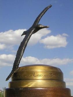
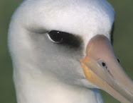
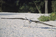
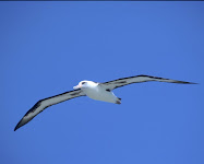
Alby is a Laysan Albatross. He was born and raised in the Midway Islands, not far from the very same Laysan Island that gives names to all the individuals of his species. His parents fed him for six months. They alternated trips of one or two weeks, during which one of them was feeding and the other was protecting Alby and the nest. The long intervals were necessary because often the food was very far away, up to 400 or 600 miles away. They fed him until he became as big as them, and then suddenly deserted him. They did that because they instinctively knew that he was developed enough to take care of himself from then on. And they could not spend all their energies in raising a chick. Although they can live 40 to 60 years, they can only raise a chick every couple of years.

The young albatross did not know all the tricks of life at sea, and the first year he had difficulties at times. One half of the fledglings do not make it through the first season, but Alby did, and everything was much easier after that. He went out on the open ocean and did not come back for years, not touching land at all, living off the bounty of the ocean, sleeping on it, learning to travel using the wind forcing the air up against the moving ridges formed by the waves.

Alby came back to his native island when he was three years old, because his biological clock was giving him the urge to look for a mate. His tentative dances with prospective mates were as clumsy as those of the other young albatrosses around him. Naturally nothing happened, but he experienced and practiced the ways of the elders.

He is 4 years old now. He has wandered the ocean all this time. He has gone through the vast expanses of water finding food, freedom, and safety. He has gone to the north Pacific and flown around the Aleutian Islands and the Gulf of Alaska and the fiords of British Columbia. Next year he will try again to go back to his birthplace to search for a mate, and probably will find one.

Albatrosses are at home in the open ocean, keeping at least 30 miles offshore. But Alby is different. He is curious about the land, just as curious as a young soul can be. In his voyages near the northern seashores he watched eagles fishing for salmons. That was not his preferred food, but he looked with interest at this different method of fishing. He communicated with the eagles, answering their whistles with his screeches.

He is fascinated by the land, but unable to penetrate it - he is used to mastering the wind over the waves, and the different way of flying inland is unfamiliar to him. He asked Eagle about the extent of the land, and Eagle said that there is land up to the summit of those far away mountains to the east, and more.

One day he met Pelican, and while they were floating and chatting over the gentle waves of a mild afternoon he learned that Pelican had actually been inland while flying with his flock. He had flown across the fertile valley of California, and over the magnificent mountains of the Sierra Nevada and farther more to the northeast. Alby learned that inside the land, beyond those far away mountains, there is a great lake, and peaks with snow, and forests and valleys, and towns and people.

Pelican described the beauty of the land, which is called America, according to what he heard when people talked about it. Being a sociable character, when he was inside the land Pelican also had contacted other big birds and knew a good deal about what lay farther inside that large country.

Pelican learned from the other birds that there are large deserts and arid mountains in the interior highlands. There are very few people in those deserts, few roads, few machines. Nature is mostly untouched by man there, with many animals running free. The air is not disturbed by artificial smells and mechanical noises. It takes many days of overflying this natural environment before reaching the majestic mountains of the Continental Divide. Here the land is green again with large forests. Snow may remain up to late summer, the rocks are harsh and austere.

From there one can overfly the vast farmlands that gradually decrease in elevation until they make room for the mighty rivers that cut the America land in two. Pelican had also contacted seagulls that told him about more land to cross going east, with plenty of houses and towns and people. There are cities sporting very high buildings that tower up toward the sky. There are rivers and lakes where an aquatic bird can feed. He heard tales from vultures and hawks that there is another long range of lower mountains and beyond that, couple of days away as the crow flies, there is ocean again.

Alby would like to go inland, see the beauty of the country, but he is not fit to go there. He does not know how to master the thermals the way eagles, pelicans and other birds with big wings travel there. He is made for the ocean.

Still he would like to go and try to cross this enormous island that he cannot cross, and get to the sea on the other side.

One day he flies along the shore, and sees some very big wings flying along the cliffs of the big town called San Francisco, as he understands people call this place.

Approaching those big wings, he realizes that there are people hanging on them. He discovers then that people cannot fly on their own, but have created artificial wings that support them. He knows what they are doing; he knows how to fly along the cliffs. He knows that, ‘cause such was the very kind of flight he took when he left his nest for the first time.

Soon those cliffs become a favorite place for Alby. He flies there often and so close to the flying people that learns many of the words they speak. He listens and learns that there are even bigger and faster flying machines with long wings for the people that like to fly like birds, which are called gliders or sailplanes. And there are flying crafts with propelling engines, capable of transporting many people at high speed. He understands now what are those enormously high flying machines that cross the ocean, so high that he barely can hear their sound through the whistle of the wind.

The flying people are impressed by the unusual behavior of this albatross, which so often flies with them instead of flying far away in the ocean like others members of the same species. They imagine that Alby wants to travel ashore, but does not trust doing it by himself.

The soaring people offer to take Alby inland, and to show him the beauty of the countryside. They offer to take him aboard their flying machines and let him cross this big island in silent winged crafts, no noises, no vibrations, no offending gas smells.

Alby accepts the invitation. He wants to see the mountains, the valleys, the lakes, the deserts and the forests, and the towns and the towers, and the roads and the bridges and the rivers of this beautiful land called America. He realizes that it is not possible for him to travel here alone, without the help of the flying people.

So the soaring people take Alby in their silent aircrafts across that vast territory. They understand. Because they themselves share the curiosity, the need for adventure, the thirst for knowledge of that young spirit. They share the independence that flying gives, the endless autonomous decisions that need to be taken in this constantly moving environment. They know the far-reaching view that this privileged position allows. But most of all, they share the elation of infinite freedom by being immersed in the sky, floating, suspended in the brilliance of this transparent ocean. Those are the reasons why they aimed for the skies, and now they cannot live any more without the magic of flight.

They take Alby with them, in the togetherness that unites all aviators. Alby’s great voyage has just begun.


Rules

ORGANIZATION OF THE VOYAGE

This website is recording the flights of Alby, his whereabouts and his flight log. The webmaster of the site is the Albymaster. All news and inquiries about Alby will be handled by this site.

Alby wishes to soar across America. He wishes to see it all, from the Pacific Ocean to the Atlantic, and then resume his wandering life across the seas.

Alby flies only in aircraft that use the energy contained in the atmosphere as a means for traveling. Motorgliders can use their engine only for taking off.

A proposal to fly with Alby shall be sent to the Albymaster. A proposal shall include a pre-declaration of the proposed flight.

Preference will be given, in order, to the site that is closer to Alby’s current location, to the first proponent in order of time, to soaring clubs or associations, to groups of pilots, or to an individual pilot. This means, for example, that an individual pilot has to wait for the soaring club to fail its attempt, before making its own attempt.

A club or pilot that has proposed to fly with Alby and has been accepted by the Albymaster, will be called the Albypilot. When a proposal is accepted, the flight should be made before the end of the next Friday.

If no other Albypilots have made the flight on their assigned week, the hosting club or pilot will have the right to make the flight before the end of the next Friday. If the host did not propose or is not able to make the flight, the next Albypilot shall make the flight before the end of the next Friday. And so on.

RULES FOR THE FLIGHT

Gliders can be towed to an altitude not exceeding 3,000’above take-off. Motorgliders will shut off their engine before that altitude is reached. The release or engine shut-off point shall be west of the take off field.

Each landing point will be to the east of the take-off point. If difficulties arise, an occasional back leg may happen, when accepted by the Albymaster.

The flight should end in a soaring site, or a place from where a glider can be towed out. If the flight does not end in the pre-declared location, the Albypilot or a pilot of the same club still have to the end of the next Friday to try and complete the flight as declared. If the pre-declared location still is not reached, Alby must be taken back where it started (not necessarily by flying).

Both the current host of Alby and the new host shall communicate the outcome of the flight to the Albymaster.

If the flight cannot be made before the end of the next Friday by the first Albypilot, it is the responsibility of the first Albypilot to give notice of the inability to make the flight, with timely courtesy, to the Albymaster, to the host, and to the second proponent in line.

The Albypilot who flies with Alby is responsible for keeping good care of him. When the Albypilot represents a soaring club or association, the representative of the club or association will be responsible for the well being of Alby.

The above rules may be superseded by the Albymaster when atypical circumstances arise.

Order of Preferences:

1 - The club that is closer to Alby’s current location
2 - The club that proposes first in order of time
3 - Clubs, soaring associations, soaring centers
4 - Group of pilots
5 - Individual pilots

ACCESSORY RULES

When start altitude, release to the west, landing to the east are difficult because of special local conditions, an exception may be requested to the Albymaster.

When an Albypilot cannot make the flight in the week he/she has been assigned, another Albypilot can make the flight provided he/she has been accepted by the Albymaster.

LOGBOOK, LAPEL PINS, SPOT DEVICE, GPS TRACE

LOGBOOK - Alby travels with a logbook. The Albypilot will fill out the log entry and sign it. The flight data will be e-mailed to the Albymaster and an entry will be placed in the website logbook. A description of the flight and pictures may also be sent along with the flight data, to be posted in the website. Enter all flights, successfull or not.

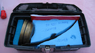
LAPEL PINS - The Alby case contains lapel pins. The pilot(s) successfully accomplishing a flight will get one pin each. The lapel pins are numbered. Check in the log book for the last pin number and take the subsequently numbered pin(s). If the flight is not successfull, place a bar in the last column (Pin No.). Please guard carefully the pins, we do not want them to misteriously disappear.

SPOT DEVICE - The SPOT device is to be placed in the glider in a place where there is sufficient visual contact with the outside (inside a shirt pocket is OK). It is to be used during the flight and placed in Alby's case when not flying. Instructions for use are in the case.

GPS TRACE - Pilots are encouraged to send their GPS log no matter how successfull the flight, as it will be posted in the map (flying with Alby is already a great success, to be recorded and displayed). Alternatively, it can be downloaded to OLC.

DISCLAIMER

Pilots who participate in Alby’s voyage acknowledge that it is a voluntary effort, and that the timing, route selection, weather decisions, and all other aspects of the flight are the sole responsibility of the pilot in command of the aircraft in which Alby is transported. The Organizers of Alby’s voyage, retain all rights to the concept, images, logbook, Alby trophy, and eventual chronicle of the journey, but neither they nor volunteers involved in the project nor the Pacific Soaring Council (PASCO) nor the Soaring Society of America (SSA) are in any way responsible for the decisions of the pilots that carry Alby in their aircraft. When pilots propose to carry Alby on part of his journey, they warrant that they have sufficient experience and will exercise all due caution to ensure the safety of their flights. By allowing pilots to carry Alby, the Organizers of the Alby project are merely keeping track of and attempting to facilitate the continued progress of Alby’s voyage.

WAIVER AND ASSUMPTION OF LIABILITY

Please accept me as a participant in the Alby voyage. In consideration of acceptance of this entry, for myself, my heirs, executors, administrators, personal representatives, successors or assigns I hereby release and discharge the Organizers, The Pacific Soaring Council (PASCO) THE SOARING SOCIETY OF AMERICA, INC., and their agents, representatives, employees, successors or assigns from any and all claims for damages or injuries suffered by me or by any member of my crew during the aforementioned soaring venture.

I further agree to assume full responsibility for and to indemnify, defend and hold the aforementioned entities and persons harmless from any and all legal obligations for damages to personal property owned by, or injuries suffered by, any spectator or contestant or personnel of the aforementioned entities, or by any other person or entity, which may be caused directly or indirectly by my participation in the venture. I further certify that I have read, understand, and agree to abide by the rules and regulations of the aforementioned endeavor.

I fully understand and agree that I am waiving any claim for damages that I may suffer by virtue of any act of negligence arising in the future by any act or omission of any of the aforementioned entities or persons or their agents, representatives or employees, and that the consideration for this waiver is the permission by the sponsoring or presenting bodies of the aforementioned venture allowing me to participate in the said venture and that such permission is being granted me in the reliance upon this waiver as set forth in this entry form.


Logbook


Tracking the flights with SPOT


Tracking the flights with SPOT


Where in the world is Alby?


Scroll below to follow Alby flying in real time. For more detailed information on the flight go to our Spot satellite tracking page.


Position updates are broadcast in real time every 10 minutes, although occasionally there may be delays. If Alby is not flying at this time, the trace shows Alby's most recent flight. Traces are left posted for the duration of one week only. However, the flight can be seen on OLC.