(Straight distance: 301.6 km. - Volkslogger distance: 330.6 km.)
This report is being started on 19 May 2009. Its completion will likely take a few days. Beginning by sitting here in the comfort of my own bed rattling words off on my laptop with the ability to access the Alby blog, plus access OLC, plus review my flight courtesy of SeeYou and Volkslogger, plus look at inputs from Greg n' Peg (my ground crew) makes me realize how much help I really have had to experience "The Joy of Soaring".
Prologue
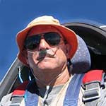
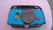
I had crewed for Mark Ferstl in his attempt to reach the Prescott Soaring Society (PSS) gliderport (Coyote Run) on Saturday, 16 May. After he returned to Jean, landed, and we put everything away, we talked about it being "my turn". Mark was scheduled to be the tow pilot on the next day and I had volunteered to give the task a whack if he couldn't. He most graciously gave me the special chart printouts George Caldwell had produced for him, plus his Phoenix Sectional and a picture of the Coyote Run gliderport (formerly Coyote Springs) that Jay McDaniel had produced with Google Earth inputs. We also sorted out items like the oxygen regulator he used (turned out it belonged to the club) and other miscellaneous stuff. Before I left home for Jean on Sunday, 17 May 2009, I figured out my route and loaded it in my trusty Volkslogger.
The Plan...
was very straightforward. I would launch in our club LS-4 (9B) a little later than Mark had the day before (no earlier than 1330) because the atmosphere didn't start really working for him until around 1500. Then I would head for Searchlight, NV via the McCollough mountains and make a go/no-go decision based on what I found there. My planned route went almost due east from Searchlight to Seligman, AZ and then to Prescott; but I figured to cross the Colorado River at a narrow point near Laughlin, NV to the southeast of Searchlight. The Colorado is known as difficult to cross because its lakes cool (and stabilize) the air over a wide path even when it's really hot on the river. After that I'd run over to Kingman, AZ and then follow I-40 to Seligman (to stay within reasonable distance of possible out-landing airfields) before turning for Prescott.
Murphy Strikes
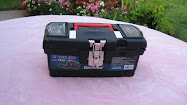
Things went pretty well insofar as getting things into 9B (my 14V battery, Alby's toolbox, 2 quarts of water that I wouldn't take even a sip of, the O2 gear, my backup Garmin GPS96, parachute, lumbar pad, etc. etc.). It's a wonder there was any room for me. We use our FOO (Flight Ops Officer) golf cart to tow out to the far (south) end of the eastern (glider) runway and positioned first in line for takeoff around 1340 local time. Almost anything metal was too hot to touch, so I put on a pair of flying gloves and promptly had difficulty securing seat belt/shoulder harnesses, getting WinPilot (fed by the Volkslogger) started properly on my PDA. I finally got pretty much settled down, ran my takeoff checklist, and hooked up to the tow rope; but a niggling discrepancy kept popping up: I couldn't get WinPilot to do anything except say that it couldn't find the GPS. Finally the proverbial light bulb illuminated my cranium: I had neglected to connect the Volkslogger to its power source/data output cable. DUH!!! I called Mark in the Pawnee and informed him I was aborting the launch, pulled the release to drop the tow rope, and asked the throng assembled to help me launch to push me back off the runway so I could sort things out.
Because I was the only one who knew exactly what needed to be done and it was difficult to see amongst all the different items that were behind the headrest, I had to unsnap, undo, release, take off all of the paraphernalia I had just connected and get out. Fortunately, one of the other club members was ready to go, so he set sail while one of my ground crew (Greg Carlson of Greg&Peggy fame) helped me insert the forgotten connector and ensure that it was secure. Then I had to repeat the whole ummph, snick-snick, plop, squirm, click, snap-snap, ad infinitum (it seemed) process of getting back into 9B and setting everything up (or settling it down, depending on your point of view). Anyway, WinPilot came up normally, the tow ship landed, and my crew pushed me back out onto runway 2R at Jean about 1405. I ran through the takeoff checklist once again, got hooked up, closed the canopy (remember, this was a hot day), and signaled I was ready to go when the tow rope was "un-slacked".
Starting Off
We started off right around 1410, a little later than I planned but still at a perfectly acceptable time. Mark knew that I needed to release to the west of Jean Airport (0L7), so he circled around to the east and crossed the field at about 4500 feet and headed for the acrobatic box that lies about a mile west of 0L7. He found a pretty good thermal there and circled back into it. When I felt the surge the second time around, I released (the logger shows 5633 feet MSL at 14:14:44) and Alby was soaring (again) at last.
The thermal wasn't all that strong, but I stayed with it until I had gained about 1300 feet before heading east toward a lift area we had gone through before crossing the field. That particular altitude gain was my first mistake, because I crossed the field more than 3000 feet (or 1000 meters) AGL, so the task I had set into the Volkslogger didn't start and I was without any of the relevant information (like the display of where my destination was on my PDA) for completing the task I had loaded so carefully only hours ago.
I found the area of lift I was looking for, but it wasn't as strong as I had remembered (250 iron ponies will create a lot of up to fool you), so I started "fishing" around without much success before heading toward the center of our east Climb Window (an area we have an agreement with the local Approach Control to climb above the top of the Class B airspace until reaching 10000 feet MSL). I found a fair thermal (3.3 kt average) that got me to 9300 feet before it wasn't worth working anymore and "headed for the hills" (the McCollough mountains southeast of Jean). If I couldn't find decent lift over the McColloughs, I planned to emulate Mark and just have fun locally.
When I got near the McColloughs headed toward Searchlight, NV, I finally encountered the first decent lift of 5.1 knots average that took me to over 12800 feet and then just adjacent, from 12700 feet to over 15300 feet at 5.8 knots. This was more like what it was supposed to be! I called Greg&Peg on the radio and said I was headed out for Searchlight. Greg replied that they were going to hitch up and be on their way. Now we were committed! The time was 1456 local.
Racing the sun
I had Searchlight made and then some, so I made no real attempts to climb and just tested the lift with the occasional circle while trying to stay above 12000 feet MSL. My strategy was to look for lift over the ridges enroute (unless I ran across something really worthwhile) and do the serious climbing there. I passed Searchlight at about 12500 and just about the time I was going to get serious about climbing I ran into a 5-knotter. I tanked up a thousand feet and headed for a ridge that was halfway between Searchlight and Laughlin. The lift I found there was weak and topped out at 12300, so I gritted my teeth and headed out into the sinkhole. It was just that and very smooth. I crossed the Colorado river over the Laughlin bridge at 10400 feet MSL and at 1535 local. I didn't start feeling the first bubbles of lift until I was down to about 9000 feet on my way to the ridges on the east side of the river. The Riviera airport at Laughlin was my ace in the hole if I couldn't connect with lift.
I finally found something worth working at 1542 local at 8600 feet MSL. It wasn't much but it built my confidence that the air was beginning to work so after I got above 10000 feet I moved a little further ease to find something better. That occurred just a minute later and I took the second thermal to 11700 feet. I had Kingman made now, and headed for Hualapai Mountain that lay to the south and east of the airport because that's where the Cu were. I managed to mostly maintain my altitude for the next few minutes and then ran into a really nice 7- to 9-knot thermal that I took to 15000 feet. I began to believe that I might really pull this task off.
Alby and I arrived under the first clouds at the mountain at 1620 local and didn't find much there, so we moved off to the east and closer to I-40 where more-promising Cu were located. The first bump I tried wasn't very workable, but a minute later I contacted a 5-knot thermal and tanked up to 14200 feet. Sometime in here Jim Dingess in ZR contacted me and then for the next half hour or so acted as a very welcome relay to Greg&Peg who were just past Laughlin at the time. The next 20 minutes were spent running as efficiently as I could with a single circle in a 9-knot "bullet thermal" that I couldn't stick with. I got below 10000 feet about 25 NM southwest of Seligman and started heading that way when I found usable lift at about 9400 feet MSL. What started as 1- to 2-knot lift turned into 4 knots at about 11000 feet and got stronger the upper we went. The altimeter read 15300 (the Volkslogger says I was at 14921 feet at the time), it was 1718 local and the PSS waypoint I had set into the Garmin (probably the smartest thing I had done all day) was 51 NM away. I called ZR and told him I was going for Prescott, asking that he relay to Greg&Peg which he did promptly. Sometime during all this activity, ZR passed the word from Greg&Peg that they had trouble with two of the trailer tires in Kingman and were trying to find someplace open (in Kingman - on Sunday - after 1700 no less) to replace the bad ones and continue on.
Running for the roses
It wasn't going to be all that easy. I could see an area of overdevelopment lying between Prescott and Ash Fork with an extensive area of virga in the northern part (so much for the weather briefer's forecast of "no significant weather"). A shelf of thick cirrus and altostratus poked out to the southwest and covered where I wanted to go. From my vantage point, it looked like the base of the stratus was about 12000 to 13000 feet. I gulped and headed toward some Cu that were in the sunlight on the west side of the stratus slightly to the south of a direct course to the PSS gliderport.
I arrived under said Cu at 11000 feet MSL and found 2 knots that increased to 4 knots and then gradually decreased until I topped out at 13200 feet about 32 NM out. I started my "real" final glide then at 1738 local and pressed on into the murk. I couldn't see a cotton-pickin' thing along my intended path in the haze and gloom under the clouds. Large ridges and hills were visible for a long way, but cultural features weren't visible outside of about a 30-degree cone directly beneath me. I started getting anxious, and began to pay attention to what WinPilot ws telling me - I was 1700 feet below glide for PSS!! It gradually got worse (I was in and out of sink, with no lift in sight) and I began to consider alternatives, of which I had precious few. After 15 minutes I was down to 9900 feet MSL and only about 12 NM away from the field. I decided that WinPilot had been lying to me and went back to doing glide calculations in my noggin. In retrospect (I hadn't used WinPilot in almost a year), I mis-interpreted the display chevrons that were telling me I was above glide for the field and getting higher.
I picked up the runway of Prescott's Love Airport when it was at my 3 o'clock and ran into an area of very weak lift where I decided to "park" for about two minutes and collect my wits. Anxiety turned to relief when I knew I definitely could run over to Love if I couldn't find the gliderport. I had the Google-Earth picture but I wasn't going to depend entirely on that. I still was about 4.5 NM from the field and hadn't been able to pick it out. I had no clue about what radio frequency PSS used for their operations (Jay McDaniel and several other club members had been unsuccessfully trying to find out), so I decided to stick Love's freq. of 122.95 in the radio to have one less thing to do should I need to make a run for Love. I discovered after landing that Cliff had been trying to contact me on 123.30 from about 20 NM out - I hadn't heard a thing. This was going to add to the forthcoming "excitement" because now there was no way I could hear anything they had to say
The Home Stretch
I admit, inside 5 NM to go with 4000 feet AGL in pocket doesn't seem like much of a stretch. On the other hand, I was completely unfamiliar with the area and not sure what I would find as the GPS96 counted down to less than a mile and I looked down to the left. I immediately recognized the northeast end of the gliderport with its parked gliders. We had made it! Exhilaration replaced relief as I started to circle the field, made sure I put the landing gear down, and cracked the spoilers to lose altitude for pattern entry.
I asked myself as I circled the northeast end of the field, "Pattern for what?" The overcast gloom and lack of contrast washed out all the details of the scene below me. I could see the path for the winch cable (it was marked separately from the "landing area" at the northeast end) and I (wrongly) believed that I should land in the designated area. I planned to land to the north because I expected outflow from the thunderstorm producing the virga (and later, lightning) and picked out what I believed to be a "runway" just off the northeast end of the trailer clubhouse. I was now down to pattern altitude and southeast of my intended touchdown point, so I turned onto a right downwind for landing to the north. Just as I was setting all of this up, the bloody cel phone in my shirt pocket started its insistent tune!
The Finish
I ignored it! No, I did not cuss, I swear (I didn't do that either). I concentrated on adjusting my final flight path to make the spot I had picked out, dodged a plastic yellow pole and a red rectangular hat-like sign on another pole, and looked up to see a FREAKIN' FENCE right where I intended to land (I said there was excitement, earlier) about 200 feet away with us about three feet in the air! I retracted the spoilers and yanked back (but not too far) on the stick. The LS responded like the thoroughbred she is, soared over said fence, and kept enough speed to let me execute a partial spoiler very low-energy landing in a somewhat-tilled rocky upward-sloping cow pasture. I opened the spoilers, got on the brakes, tried to keep the wings level and then started swearing. The ground sloped up slightly to my right and I heard the "klock" of a rock when the right wing got too low (more cussing). The upward slope crested and started down and we stopped about 100 feet past the crest. The right wing dropped after we stopped and I opened the canopy, unstrapped, undid everything, got out and tried to handle the tremendous amount of adrenalin my body had generated about 900 feet of horizontal distance ago. I had had my fill of excitement for one day; but we were safe, I found that the damage from the rock was very minor with nothing else awry, and I could answer the phone. It was 1810 local
Peg had called and passed the word that they had found a place that had tires and stayed open to help them get back on the road. She estimated they would leave Kingman around 1830. While I was receiving this news, the first of the PSS members, Matt, showed up to see how I was doing and how he could help. He explained what everybody else was doing (taking down the fence I had sailed over so they could come get me). They did it quickly and I believed it was a task they had done on more than one occasion. After about 10 minutes, Cliff Hilty showed up with a pickup, a tow rope, and four other guys to help. That's when I learned how much excitement I had provided for them setting up the way I did and landing with a tailwind, no less.
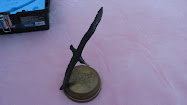
By the time we had towed 9B to the parking area and put her away it was 1845. I unstrapped Alby and handed him over to Cliff, who was going to be the next Albypilot. I discussed whether we were going to be able to put 9B in the trailer that night with Cliff and he gave me a half-dozen really good reasons why that was not a good idea. Peg called back about this time and said they were on the road, so it was apparent they were going to roll in about 2200. Time to think about spending the night and recovering tomorrow. I called Peg back and passed this suggestion on. She talked with Greg and they bought the idea. Cliff also gave her directions to where I would be hanging out in Prescott (Denny's). Then it was off to Rose's house (Cliff's girl friend) to fill out the Alby log and something I really needed at this point - a tall, cold beer.
Epilogue
Greg&Peg showed up at Denny's about 2145 and we had a very nice, loud reunion in the middle of the dining room. They filled me in on their adventures while they had dinner and I finished mine. Theirs is a tale of true grit and determination - so it is appended to this report because they are a major reason I was able to bring Alby to Coyote Run. I.
*************************************************
Crewing for the Alby, Jean NV to Prescott Valley, AZ
One hour after launching, our pilot announced that he was on the way. We gathered the gear, hooked up the trailer, and hit the road. Unfortunately, the road was I-15 South out of Las Vegas, amidst all the tourists that all flock back to LA every Sunday afternoon. Also unfortunately, the exit we needed to take was closed for construction. The next exit was five miles further, and then five miles back to the exit Eastbound.
By now, our pilot was in the next state and making 70 knots straight away from us. For the next 100 highway miles, we dodged construction zones and traffic on our convoluted route to get across the Colorado River.Our pilot was now 150 miles away, still doing 70 knots on course.
Finally, heading in the right direction, near Kingman Arizona, one of the trailer tires shed its tread. We changed the tire, and pressed on. Ten minutes later, the spare did the same.
It's Sunday, 7 PM, in Kingman, Arizona. What to do? We bribed a tire seller to stay open late and mount tires.
Our pilot was now on final approach to the Prescott Soaring Society Airport, four hours after his departure from Jean. We were nominally three hours away.
Following driving instructions, we looked for our turnoff from US89 at the 20 mile point. Driving slowly, irking the drivers behind, looking at every street sign, we found our turnoff at the 45 mile point.
Seven hours after our departure from Jean, we finally found our pilot at Denny's in Prescott Valley, Arizona, the pilot not worried about his crew finding him.
Leaving our pilot at the motel, and resolved to find the glider, we left Denny's at 11 PM, following a map made before major road realignment. A mid-shift convenience store attendant directed us ten miles back to the proper road, and we found the glider port.
At midnight, locating our glider, we camped under the stars and listened to the coyotes.
A wonderful day crewing!
*************************************************
Last Words
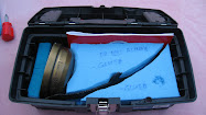
We met at Denny's for breakfast on 18 May around 0730 and headed for the field about 0830. We had the trailer hooked up, 9B out from behind the fence protecting it from the local cattle population and the fence back in place in short order. Here is a shot of everything strung out to unload the cockpit, pack 9B up and hit the road home. Note how high the fence is.

We were de-rigged, in the trailer, and out the gate with it properly locked by exactly 1000 (Note: AZ and NV local times are the same). We headed for Ash Fork and went through the mandatory road work zones, the place where they make all those tan pants (Chino Valley), alongside their laundry (Chino Wash), and the road to where they make the really big sizes (Chino Grande). Shortly afterward, Greg heard "something funny" so we stopped at the first available turnoff to investigate. Somehow, despite the fact that both of us had used all the strength we had to tighten and check the security of the front jack on the trailer, it had vibrated loose and had been dragging on the highway. The wheel was toast, so we positioned the jack in its proper position and Greg torqued it with a hammer.
We kept pushing on, retracing their route out (not the detour part, thankfully) and rolled into the Jean airport at about 1530. Tie down, equipment transfer, ruined front jack removal from the trailer and securing the club gear took only a short time. I had my laptop and the Garmin serial cable in my Ford "Exploader", therefore we headed for an Irish bar with cold beer and free public wi-fi so I could download the flight and submit it to the OLC. I discovered later that the Garmin trace was 3 km. shorter than the one on the Volkslogger, but it didn't really matter. Greg and Peggy Carlson were the first to see what we had accomplished, and I can't thank them enough. Pilots don't talk much about it, but the ground crews are the backbone of the cross-country part of our passion and we (pilots) all need to remember that.
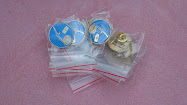
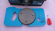
I'm proud to wear Alby pin # 8.
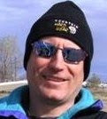
Shad Dvorchak
SSA # 800279
View Flight on OLC


.jpg)
.jpg)
.jpg)
.jpg)
.jpg)
.jpg)

.jpg)
.jpg)
.jpg)
.jpg)
.jpg)
.JPG)
.jpg)
.jpg)

.jpg)
.JPG)