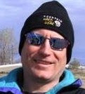
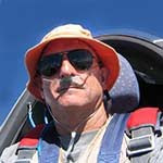
 I met Steve and Reba Altman at the North Texas Soaring hanger in Decatur after I got off work Saturday. After looking at a couple of driving routes to Littlefield, Steve suggested we drive the one that was closest to the planned flight route so that we could study the terrain and check out possible land-out sites. We hitched up the Libelle trailer to Steve's truck and headed west at around 3 PM. We saw some vast areas of beautiful and colorful country. We saw some vast areas of ugly land-out possibilities. When we arrived in Littlefield, we drove out west of town to find the airport then checked in to the newest and nicest Best Western Motel in town. The lady at the desk gave us directions to a great authentic Mexican restaurant where we enjoyed a great meal. The forecast for Saturday was for a 40% chance of thunderstorms. As we left the restaurant we were treated to a spectacular display of lightning and could see the glow created by a large field fire caused by lightning strikes. I think all of the 40% thunderstorms hit Littlefield overnight; the other 60% went somewhere else.
The plan was to get an early start, utilize the legendary west Texas thermals to climb somewhere up in the teens and then cruise east 280 miles and land back home at North Texas Soaring in Decatur.
Take-off from Littlefield 12:35 July 19
I got off the ground a little later than planned, but as it turned out; it didn't much matter because the legendary west Texas thermals were late starting. I got off tow at 3000 AGL west of the airport and in dead air. I could see that most of the flat fields surrounding the airport were pretty wet. I found the first thermal just east of the airport, and it was not legendary. Due to the wind being around 20 knots out of the south, it leaned way to the north and was scrappy and fell apart just before getting back up to tow release altitude. I decided that the best bet would be over town where there was some dry asphalt and dry roofs to maybe generate a legendary thermal or two. There was a huge black field south of town, the one that burned up the night before. It consistently kicked off thermals but they were still the non-legendary kind that leaned over and fell apart at 28-2900 AGL. For almost two hours I kept grinding my way across Littlefield, circling and drifting north, gliding back south to start over again. I bet the folks that live there are still talking about it.

My plan at this point was to just keep sampling the thermals, wait it out until one of them became legendary, then head east. Finally I was getting a little higher, maybe 35-4000 AGL and then Steve called me and said he and Reba were about 10 miles out of town and were waiting to see what happened. They said I answered by saying something like "ummm, wellll ok, guess I will head out too". So I headed pretty much due east for my first checkpoint which was the town of Abernathy. Tom Pressley and the guys at Caprock Soaring had told me that if I stayed north of Abernathy I would be safely out of Lubbock's class C airspace. It actually wasn't that bad. The thermals were regularly spaced and gradually were getting a little higher, but still costing me in a lot of drift across course while climbing.
After clearing Lubbock the plan now was to just keep pushing east, correcting for the relentless wind drift and staying as close to course as possible. Slowly the checkpoints of Cone and then Crosbyton slipped past my wings. There were some medium high cloudstreets every now and then, but they all ran north-south and were spaced about 20 miles apart, and they gave up altogether as I approached the edge of the Caprock, where the elevation of the terrain drops off fairly quickly from 3500 MSL to 1500 then 1000. This is also where the badlands start and where there is 40 mile stretches of unlandable stuff. Just before leaving the high country, I finally found a couple of almost legendary west Texas thermals, showing 8 knots to my highest for the day of just a tad over 9000 ft.
For the most part, I was staying high enough where I could see landable fields scattered around the badlands within reachable distance. By that I mean that with the use of a thermal or two I could reach them, and failing that, I could leave course and head over to the highway where Steve and Reba were going east, and land there.
The only bad period I had was caused by a tactical error. After heading out off the Caprock with a comfortable amount of altitude but over the longest stretch of bad terrain for the day, I could see a very large blue area which no doubt contained a lot of sink and not much lift. North of the highway about 20 miles or so is a string of huge wind turbines and I could see several areas of flat farm fields scattered around them. There was also a few cumulous clouds there so I decided to veer off course and go around the blue hole. You know what happened next. The closer I got to the clouds the more ragged they became until they completely dissipated. Now all I found was sink and lots of it. The blue hole was pushed north closer to the wind farm and some better looking stuff had drifted in behind it. I turned back to the south to get out of the sink and surveyed the situation. I was within gliding distance of the highway about 15 miles away but didn't have enough altitude to get to the east side of the badlands. I headed a bit to the east but mostly back to the highway. About three miles north of the highway and 2500 AGL I found a fair thermal and climbed back up high enough to continue east to some landable ranchland. If I had just continued on course but aimed into the wind, I would have been able to skirt the south edge of the poor stuff and saved a lot of time and gained some extra miles as well.
Next checkpoint is the famous 6666 ranch. Pioneer oilman Amon Carter won the ranch in a poker game with a hand of 4 6's. It covers almost all of a very large Texas county and is still owned and run by his heirs. It is out in the middle of nowhere, folks. There is a world class paved and lighted runway adjacent to the highway on which family and friends come in their biz-jets. The ranch complex looks like a well maintained small town. I am told that they frown upon people landing there without a really good reason to. It looked like mine might be the classic glider pilots' reason: the wind quit, or least that was what I was going to have to make the ranch hands believe was my excuse.
 Steve and Reba were parked in the shade of a few Mesquite trees at a rest area a couple of miles west. I could plainly see them sitting there. I was finding a thermal every now and then, and while I wasn't getting very high I was encouraged to keep pushing east. By this time the day was waning, and I was finding lift was topping out around 4500 or so, but it was still there so I kept on marching along. The next checkpoint was Munday and as I was getting closer to it, I could definitely feel that the day was almost done. There is a nice airstrip at Munday, but to go there I would need to deviate south of course by about 5 miles. On the other hand, the airport at Seymour requires that I go north of course about 5 miles but puts me further east and that much closer to the goal at Decatur. I could actually see what I guessed were water towers and grain elevators way off to the east, and thought that must be Seymour. I am 22.8 miles away and not high enough to make it. Just then I ran into the last thermal on earth for this date, and thankfully cranked around into it. It was a nice ol' thermal and by hanging onto it and milking it, I managed to get just a bit over 5000 ft and earned a nice final glide.
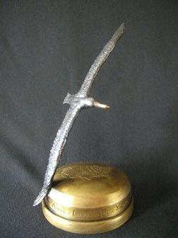
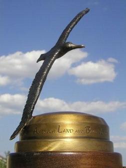
I arrived at Seymour with 700 AGL and entered a right hand pattern and landed to the south. Steve and Reba showed up about 20 minutes later (they had gone to Munday earlier). We had planned on leaving the Libelle tied down overnight, but after remembering what it was like at Littlefield the night before, and also seeing a big black wall off to the North West, I decided to de-rig and put the Libelle back in the trailer. We parked the trailer between two hangers and hit the road for Decatur. I was proud of my old ship for doing such a good job on such a challenging day, proud to get Alby moved on 180 miles closer to the sand dunes at Kitty Hawk, and extremely proud of and thankful for Steve and Reba's support. I would not have been able to make this flight without them. It is such a great relief and boosts your comfort level tremendously when you have a crew supporting you from ground level, and especially when you get the expertise and advice of a super CFIG like Steve Altman thrown into the bargain.
Thank You, Thank You, Thank You.
View Flight on OLC
Alby's Log: Leg #13, Littlefield to Decatur (leg two)
At my home in Gainesville I woke up to the sounds of thunder and heavy rain. This was the next morning after landing at Seymour, and I had planned on finishing Alby's Voyage to Decatur today.
 Late night phone calls from Steve Altman and me to Francis Berryhill and Jim Vickery, the ramrods of our club, North Texas Soaring, had placed the next phase of this adventure in motion. Steve and Reba would not be available to continue crewing because of work schedules, so it was arranged for Glenn and Elizabeth Maynard to take over. Towpilot John Thomas quickly rearranged his work schedule at Lockheed so he would be available after noon.I got a phone call from Glenn in Denton where it was also pouring rain, and he asked me if I was optimistic about the chances of making the flight. I had just checked Dr. Jack's Blipmaps and my interpretation was that the flight could be done if the rain quit early enough. The weather forecast was for the same thing for the next three days, chances of thundershowers in the AM and clearing in the PM, with 15 to 20 knot winds out of the north. I told Glenn that we should go for it, so he and Liz met me at the North Texas Soaring hanger in Decatur at 10:30 AM. It was still raining, and radar showed solid thunderstorms all the way to the Red River north of Wichita Falls. Glenn suggested we adjourn to Starbucks for further consultation, so we did. I called John at work and advised him that we were on hold for now. Finally the stuff began to dissipate and move off to the south, with clearing coming in behind it, but by now it was 12:30 and I could see there was quite a bit of high cirrus coming along behind the thunder cells. So the game was called and rescheduled for Tuesday. We all went home.
The next morning the same thing happened, woke up to the sounds of Thor slinging his hammer around the skies and rain pouring down at my house. Weather radar looked about the same as yesterday, except it looked like it might move out earlier this time. Dr Jack's Blipmaps didn't look as good because of expected winds tearing the thermals apart. Still, it looked possible, so I had my breakfast, kissed Sharon and granddaughter Sydney goodbye, and headed for Decatur. I got there early enough to get our good old Agwagon ready for John. Put a tow rope in, charts and jumper cables just in case and she was good to go. Glenn and Liz showed up shortly after that, and after a final phone call to John in Ft. Worth telling him it was a go, we were off to Seymour. I must say that as far as crews go, Glenn and Liz showed every bit as much hospitality as Steve and Reba had. They continually offered me goodies like Starbucks high octane brew and deep fried stuffed Jalapeño peppers. As we drove on through Bridgeport, Jacksboro, Olney and into Seymour we constantly were looking for and grading potential land-out fields along the way. I was encouraged to see small cu's developing but wished they would get up higher. They appeared to be 2000 to 2500 at this time.We had just arrived at the airport in Seymour and hooked the trailer up when we heard the Agwagon coming and saw John enter the pattern. He landed just in time to help rig the Libelle and it didn't take much time at all before we were all set to go. The wind was blowing straight down the runway out of the north and the windsock was standing straight out.
 The plan now was to take a tow, release west side of the airport and see if the thermals were holding together in the stiff wind. The plan was to use the plentiful cu's for markers along the route, staying as high as possible below cloud base which was at this time, less than our planned 3000 ft tow.
 The first thermal I got into off tow was a good one, held together OK, but Oh My Word! You talk about wind drift. The airport is about 4 miles north of town and as I circled in the lift I crossed the town north to south in a matter of minutes. Now it was time to get to work and get moving along course. Because I couldn't get high, I flew from cloud to cloud in a zigzag fashion. I would fly at about a 45 degree angle between course and wind direction, aiming at the next best looking cloud upwind. Almost every cloud I came to was working so I would take as many turns as I wanted in the good stuff, and just dolphin through the mediocre ones. While circling, the wind would shove me south and then I would head out northeast and repeat the process. I could see that this was not going to be a record breaking pace as the lightning bolt shaped course was netting me just about half of the groundspeed I would have achieved with no wind.
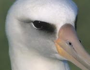
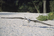
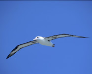
 Even so, it was so easy that I imagine a Caveman could do it. Cruise at about 60 - 65 knots, climb under any cloud you want, push it a little faster through the occasional sink between and next to clouds, don't get too low, repeat process. I caught sight of Glenn and Liz twice along the way. They had no trouble keeping up with my pace, even though Glenn had to stop at every Dairy Queen he came to and get some more of those Jalapeno Poppers.It even got easier for a while because cloud base had crept up a bit during the strongest part of the afternoon, and the wind speed had eased off a bit as I got further east and south. Along with that, however was the fact that overall conditions were softening. As the sun moved lower toward the horizon, the wet ground and milder temperatures became more of a factor. After the flight, Liz told me from the ground it appeared as if the Munching Critters from a PacMan game were gobbling up the clouds after I used them, and they were gaining on me.They finally caught up with me about the time I came to the Bridgeport airport and began to eat up the clouds ahead of me as well. It was about this time that Alby and I began to have chats. He would say "Dean?" "Yes, Alby" I replied. "Are we getting in trouble here? It seems that we are just going around in circles and not gaining any altitude" "I agree. The day is dying so fast that I'm beginning to wonder if we may have to land." "Dean?" "Yes, Alby" "How much more do we need?" "Alby, if I could just find one more thermal, we could make it." "Dean, there are three of my Turkey Buzzard cousins, climbing rapidly, over there about 3 miles south of us. I'm sure they wouldn't mind if we went over there and used some of it." "Good idea, Alby. Let's go for it!"
 Alby is one smart bird! Even though his cousins did mind (they ran away as soon as the big bad Libelle started circling with them) there was a brief period where one of the Buzzards was circling off our wingtip about 100 feet and watching every move we made. It was great, got us back up to about 3700 agl and was good for a pretty fast dash home the last 15 miles.
Once again, Kudos and more for the crew(s). Thank you all so very very much for making this truly wonderful adventure possible. Jim, Francis, John, Elizabeth, Glenn, Steve, Reba, and the guys at Caprock Soaring.
Thank You All. Dean Forney
View Flight on OLC





.jpg)
.jpg)
.jpg)
.jpg)
.jpg)
.jpg)

.jpg)
.jpg)
.jpg)
.jpg)
.jpg)
.jpg)
.jpg)

.jpg)


