ACKNOWLEDGMENT: Alby's Voyage is promoted by the Pacific Soaring Council(PASCO), and encouraged by the Soaring Society of America (SSA). PASCO represents about 400 glider pilots of Northern California and Nevada. The SSA represents about 12,000 U.S. glider pilots. Like Alby, both organizations foster and encourage all forms of soaring.


Alby's Progress

Map Legend

___ Successful Legs

___ Attempts

___ Proposed legs

___ Trip "by glider" to NY


Click, hold and move the mouse to move the map.

Point hand's finger, click on markers to read airport information.

Point hand's finger, click on path legs to read flight information.

Click on Sat (bottom left) to see aerial picture, enlarge to see airport.

Click on "View Larger Map" above to see full screen .


latest news


11/10/2017 - Sarah Arnold and Karl Striedieck fly the ridge, take one thermal to climb to just under cloud base and fly straight with no turns to Harris Hill, NY. Pins no. 32 and 33. Trafford Doherty, Director of the National Soaring Museum takes Alby in his care. Alby has now completed his Voyage.

8/5/2017 – Shane Neitzey took Alby from Front Royal to Eagle Field with a spectacular ridge flight – plus some thermals. See the flight on the OLC. With his flight Shane gained Pin No. 31.

Alby is now in the capable hands of Karl Striedieck who will make the final leg to Elmira, NY venue of the National Soaring Museum. This last leg is tricky but Karl is confident he can make it, with the best period for the attempt in October.

8/4/2017 – Dave Reilly flew Alby from Culpeper to Front Royal, completing his leg and earning Pin No.30.

7/16/2017 – Alby is at Culpeper airport, taken there by Dave Reilly who made it almost to Front Royal, but was 20 miles short when he decided to go back a little and land safely at Culpeper. He wants to try again soon.

6/3/2017 – Mamad Takallu flies his ASW-27 from Garner to Merlin, earning Pin no. 29 with a powerful straightforward flight.

7/17/2016 – Eric Lambert after almost one year abandons dreams of making a pure glider flights, starts the engine and motor all the way from Currituck to near Garner.

9/17/2015 - Eric Lambert flies Alby from First Flight to Currituck using the engine of his motorized Grob.

9/14/2015 - Alby arrives at First Flight, Kitty Hawk, NC!

Heartfelt congratulations to Alby pilot Eric Lambert, who found reliable lift on a blue day to get Alby safely to Kitty Hawk, for a well-deserved rest. Eric's notes on the flight are found in more detail below.

Briefly, he said, "I will return to First Flight in the morning and plan to meet with Karen Warlitner, the Executive Director of the First Flight Foundation, for a photo-op. We would like to have a photo of Alby next to the Wright Flyer. On Thursday and through the weekend, we hope to take advantage of this spell of good weather to fly Alby north."

8/31/2015 - Alby flew Sunday from Chesapeake, VA to Currituck , NC with Albypilot Eric Lambert in his motorized Grob 103.

Eric said that he found clouds to 5,000’ and lift up to 4 knots. He got low (1,700’) at the Academia facility (U.S. Training Center) but got back up to 4,000’ and then to Currituck. He said it was not difficult – sure I believe it, when the conditions are good! The flight of 25 miles required only two thermals, but it was one of the very few days that there were clouds and workable lift and no adverse winds. Clouds and lift disappeared soon after the landing.

Eric wants to spend four days of the long Labor Day weekend trying to fly with Alby the 33 miles from Currituck to First Flight Airport, a place that is so historically important for all aviators. Not an easy thing to do since near the coast the weather is not favorable to soaring in general, and in this case in particular the glider has to fly for several miles directly above water.


TALES OF THE FLIGHTS


Alby flight No. 38; pin No. 16 - Bob Herndon; 6/26/11-8/6/11

Vicksburg to Starkville, MS

Alby arrived in Jackson by Fed Ex. We were not able to meet him in Vicksburg. He was not happy as he was supposed to fly from Vicksburg to Woodbridge airport, just North of Jackson, MS. Since he expected to fly the whole distance, we planned to fly him back to Vicksburg. With my first try on June 18 in our ASW 20, N3EB. I couldn’t control the plane adequately with Alby’s case on my lap, the case got in the way of the stick so I didn’t have adequate right aileron range. I had to release at 200 feet because of slack rope and made a quick 180 and landed. Alby was not impressed.


Notice that it is a sunny day. Scattered lift. I only got to 3200 staying close to home in the Grob 102.


The next try, on June 26, we flew Alby, without his case back over the Vicksburg airport where he could see the Mississippi flood, which was receding by that time. Lift was weak and it took almost a half hour to get to cloud base. Alby insisted that he could do much better on his own and didn’t seem impressed with my thermalling skills. Nevertheless, once we got to cloud base the trip proved fairly easy and we never got below 2,500 AGL until descending to land at Woodbridge. Alby got a good view of the Mississippi Delta. Since there are very few land out spots in the area around the Big Black River I was a bit nervous crossing that area but did not have any trouble with it.

On July 10, I took Alby on our first try for Starkville – It was a good day locally with cloud bases at 4,000 msl and expected to rise as the day progressed so it looked to be a good day all around. Unfortunately, half way to Carthage which is about 25 miles to the North, there was a big blue hole and the few tiny clouds in the area had bases at about 3,000 msl or 2,500 agl. Lift was weak, there were no good land out areas and I had to turn back. I got some good lift and tried again about a half hour later but again ran into the same big blue hole. Lift west of the Pearl River looked a bit better but by then it was too late to try again.

August 6 time for another try. Conditions looked fairly good with cloud base at 3,800 msl and, since they usually go up through the afternoon I expected 5,000 to 5,500 msl cloud bases by late afternoon. There are essentially no decent land out areas between Woodbridge and Carthage so getting to Carthage was a bit tense but there were some good cloud streets so I went ahead. I didn’t ask Alby what he thought of a rough off field landing but fortunately didn’t have to land out. North of Carthage, there are more airports and land out possibilities so I proceeded despite the fact that conditions were a bit overbuilt and the cloud base remained low, about 3,500 msl or 3,000 agl. As I approached Louisville, the lift appeared to be dying and I got down to about 1,200 agl but was quite close to the Louisville airport so I kept searching and was just starting a turn toward the airport when I finally hit a strong thermal and worked my way up to 3,500 msl. There was a thunderstorm just North of Louisville and between there and Starkville and Alby didn’t want to be too close to a thunderstorm. “Leave that to the Storm Petrels”. So we skirted the storm to the West and arrived at Starkville after a 3 hour 22 minute flight. George Bennett came out and had arranged a tow which got me about half way back as there was no longer any lift. I landed at Kosciusko and was picked up by my close friend and fellow CFIG in our tow plane and he brought me on home. Had I known that ceilings would remain as low as they did, I would not have even considered trying a long cross-country but it all worked out. Alby was happy to be out of his box and moving again and seemed fairly impressed with the distance and I didn’t even have to flap my wings.


Dr. Bob Herndon arriving home after taking Alby to Starville MS. Landing after rain and cloud covered afternoon.


That is among the longest flights for our club. Probably the longest was made on a good day (cross country days are a rarity here, almost all in the Spring or Fall. We have had a 9,000 foot day but only once since the clubs inception in 2003. The longest flight was probably 60 nm to Greenwood and Back by Stan Music. I think this is the second longest and the longest direct flight to a goal by a large margin. Certainly it is the longest on a 4,500 ft. max day. I did a flight of about 95 nm. round trip a few years ago but under much better conditions.


IGC file 


Reflections on flying with Alby - Dean Forney

Monday, June 15th

After much soul-searching, I have decided to go ahead and tell you a few things about Alby that I’m sure will surprise you. Who knew that Albatrosses have a temper? I guess I was so smitten with the image of Alby the adventurer, and Alby the free spirit, that I was caught completely off guard the first time he blew up and started screaming at me. I might add that he can be quite sarcastic in some of his remarks. He first started in on me when I was unloading him after landing-out in York’s pasture. I had to explain to him that this was just all part of the cross-country experience, and part of the adventure. He said he didn’t think much of it, but would try to bear with me.

The next episode was after I landed at Cypress River. That’s where he really showed his temper and we got into quite an argument. It got so heated that at one point I threatened to throw him out in the swamp and let him find his own way on without me! I know that was a childish, petty statement on my part but he insulted me by saying that a 6 month old Albatross chick knew more about soaring than I did! After we both cooled off, we made peace and apologized to each other. As I was driving home, we had a long talk. He told me that he was getting sick of riding in my truck, that he hadn’t signed on for this, nor had he agreed to sit in my study in a box for 6 months. He asked me if I had confused his race for that of Polar Bears or something else that hibernated during the winter.

Albatrosses, as I found out by listening to him, are a very patient bird, accustomed to soaring for days on end. But they do have their limits, he told me. On my side of the discussion, I explained all about how humans mimic his species the best we can, but circumstances of varying terrain and the vagaries of the weather will screw up our best-made plans from time to time. He said he understood. I had to remind him that his part of the bargain meant that he would have to just put up with our shortcomings in order to learn about our sport.

We finally both agreed that we could do better and promised to show more tolerance for each other’s differences. I’m glad we cleared that up. I just thought I should warn those of you who are traveling with Alby from here on, to be aware that if you inadvertently cause Alby to be confined for too long a period at one time, you should be prepared for the consequences. On the other hand, if you treat him to long flights, and frequently, he will talk, or even sing to you your praises. If you keep him in the right mood, he will teach you things about soaring that you could never learn on your own.

Godspeed Alby!
Dean Forney

Alby flights No. 30; pin No. 15- Dean Forney; 4/26/10; 5/24/20; 6/13/10

Notes below are from Dean Forney, recounting his 3-part flight from Midlothian, Texas to Gilliam, Louisiana. Congratulations to Dean on this exceptional leg of the journey! Ed.

The last legs from Texas to Louisiana was filled with new adventures over unknown territory and although quite challenging and very difficult at times, it was never the less a wonderfully rewarding experience.

Part 3. Cypress River, Texas to Gilliam, Louisiana

Sunday, June 13th, 2010

I had checked with Wayne to see if the towplane would be ready the weekend of June 5th and 6th. It wasn’t, and the weather was not cooperating either. They were under a Tornado Watch as I was speaking to him. I continued to check the weather as the next week wore on, and it was iffy. When I looked at Dr Jack’s Blipmap for Sunday, it looked favorable and I decided to give it a try. Friday after work I rounded up my trailer and parked it in front of the house. I loaded up everything except Alby before I went to bed. I work from 3:30 in the morning until 2 PM on Saturdays, so when I got home I grabbed Alby and hooked up the trailer. I was on the road to Louisiana shortly after 3:00. The fastest route had me traveling east across north Texas to Texarkana, Arkansas then south to Shreveport.

I made a couple of phone calls along the way, first to Wayne Crank Jr. in Shreveport, arranging to meet him at Gilliam the next day, then to Glenn and Liz Maynard to keep them posted on the latest developments regarding Alby’s Voyage. When I talked to Glenn, he and Liz were actually at The Lone Star Aerobatic Championships near Sherman, Texas where they were both competing. I passed by about 10 miles from the Grayson County Airport while I was talking to him, and was very tempted to detour there and give my support to their efforts. I still had nearly 200 miles to go before bedtime though, so had to keep on the road. By the way, Glenn took first place in his category, and Liz placed in the upper third in her advanced category, flying their Giles G-202. They wished Alby and me luck on completing this last leg out of Texas.

I checked into a motel on the north side of Shreveport around 8:30 and hit the sack. The next morning I grabbed a quick breakfast and drove the 25 miles north to Gilliam. Just as I was pulling into the Airport, I saw an Aeronca coming in to land. It was piloted by Shreveport Soaring’s Ralph Forrester and his passenger Doug Olson. They showed me where to park and then the three of us quickly put the Libelle together. Ralph is one of those guys that do anything and everything that needs to be done around the club. Today he would be our winch driver. Doug is a new member in their club and has had a couple of lessons so far. Doug’s day job is flying B-52 “Buffs” out of Barksdale AFB located at the east edge of Shreveport. It was still early and Ralph and Doug had some chores to do, so they took off to go get a lawn mower somewhere and I decided to drive over to have a look at Thackers airstrip some 8 miles from Gilliam as an Albatross flies. What I saw was dense trees, sloughs and creeks and no place to land once I got away from the Red River farmland about 3 or 4 miles out. Shortly after I got back to Gilliam Ralph and then Wayne arrived. There were also a couple of fellows waiting for the local Skydivers that operate out of Gilliam. I found out from Wayne that the club had conducted around 25 winch launches the day before, and several people had managed to climb out to cloudbase around 3000 agl. Today looked like it would be about the same. This encouraged me. While I was driving in the day before, I had ample time to think about the real possibility that today might turn out to be a series of winch launches followed by landings, or something worse (as far as Alby’s Voyage is concerned) such as a 8-10 mile flight with a landing at Thackers, Vivian, or even 28 miles away at Cypress River! I was eager to get started. The fellow that owns the airport came by and introduced himself: Mr. Danny Logan, a really nice Southern Gentleman, keeps his own 172 on this airstrip, and allows a crop-duster as well as the Skydivers and the Shreveport Soaring Club to operate here. Thank you Mr. Logan for letting Alby fly from your strip as well.

I had looked back through my logbooks a couple of days ago, and discovered that it had been over 15 years since my last winch launch or auto-tow. After talking it over with Wayne and Ralph, we all decided that it would be wise to do a couple of check rides in their 2 place Lark. Wayne got in the back seat and I in front. The first launch only netted 700 feet due to me starting the climb late. I was happy to note a couple of good bumps as I entered the pattern. The next climb was a little better, but only got about 850 feet. While we were hanging around for a minute or two, we ran into a thermal and climbed up to 1200 feet or so. Wayne suggested that we might as well stay up where it was cool for a while, but I was really eager to get back down to start the “Voyage”.

I was soon settled in the cockpit of my Libelle and Wayne was attaching the winch wire to the cg hook. My first launch resulted in 750 feet and I didn’t contact lift after release, so back on the ground for an immediate re-light. This time I got 900 feet and ran smack into the house thermal right after release. I steadily worked my way up as the wind drifted me north 2 or 3 miles. I was looking down on the paved drag strip located 1.5 miles from the airstrip. I had been warned by Wayne not to even think about landing here, because the drag strip is lined with lights and you can’t see some of them from the air. It looks just like a nice paved runway, even has a taxiway along the side. I couldn’t see any clouds within reach directly towards Cypress River, but there were some south and a bit west of Gilliam and more or less in the direction of Thackers, so I ran over to them. I was back down to 2000 or so when I got there. As I slowly climbed back up I was studying the location of clouds on course. There was pretty much nothing directly along the course line, but there were several around Thackers and a few west of there. When I topped out here I was at 3500 and so headed on to the next one. It was 6 or 7 miles out there and I was back at 2500 feet when I arrived. I wasn’t averaging much of a climb rate, but I wasn’t going to look a gift horse in the mouth. I was getting between 2 and 3 knots in the climbs.

Now I was located about half way between Thackers to the south and Vivian to the north and I was well away from the farm fields. I could look straight down and see swamp water amongst the trees. To the west there were no clouds, and the cloud I was milking gave out on me at 2900 feet. My inner voice was telling me it was time to move away from the trees, so I started back towards Gilliam. This was the right move and at the right time because I slowly but relentlessly sank toward the ground. I ran through a teeny thermal just before I got out of the swamp, but only managed to get back up to 2300. I could see that I was staying in a very safe position, and had it made back to Gilliam, but would soon be landing if I didn’t find something. It kept on until I was only half a mile from Gilliam and at 1100 feet. Literally at the last minute, I found the house thermal, and cranked my way back up to cloudbase, and yep, drifted back over Thunder Road again. The clouds were right about where I found them the first time, but had improved in the sense that the tops on some of them were building and a few had developed those good looking concave bases. In fact, by scouting around different spots under the cloud I was working, I found a sweet spot that gave me 4-5 knot lift and topped out at 4200.

Now I was ready to make a serious charge out west, and off I went. I ran out to a cloud that was about the same place where I quit the first venture, and got from 2600 back up to 3800. This afforded me the chance to go for a couple more clouds off to the southwest. My dilemma wasn’t an inability to get along the course; it was getting enough altitude and/or close enough together to be able to stay in the lift band. It’s one thing to be able to make it to a landing place, and quite another to arrive there with enough altitude left to hook up with some more lift. It accomplishes nothing if you land at a checkpoint along the way. After one more run to the next cloud, I was a couple of miles north of Cypress River and working some mediocre lift. The wind was blowing out of the south, so I was drifting farther away from the airport as I climbed. By the time I topped out I was at 3500 and was wasting more time than I was gaining. At least I had enough to run into the airport for the remote start, and I crossed the runway at 3000 feet.

After 2 ½ hours in the air, Alby was now officially on his way to Shreveport. There were neither clouds nor lift that I could find around Cypress, so off I went back north to the cloud I had come in from. It had moved quite a way farther north so it cost me 1000 feet to get there, only to find it had completely died while I was gone. All of a sudden the situation changed from good to bad. There was nowhere to go except for the safety of the runway back at Cypress River. I set a course straight for the airport, desperately scrutinizing the ground for anything that might make a thermal. About the time I had resigned myself to the fate of a forced landing at Cypress, I spotted a small area where the trees had been clear-cut around the top of a small hill. I veered my course off to the right, and just like the textbooks promise, there was the nicest little thermal you could ask for. I was only a mile from the runway, at 1100 feet above sea level and the terrain here is around 300 msl. Folks, that means that I was 800 feet above the ground. This was one of the best saves I have ever pulled off. I worked it for all I was worth, too! You can bet that I wasn’t going to blow this one. I had to go pretty steep to stay in it, but the higher I got, the better it got. This is what soaring is all about!

A cloud began to form above me, the lift had picked up to 3 knots (I thought this was excellent by the day's standard), I could see another cloud to the east that would be reachable and was right on course for home. Then I saw a rainbow between the next cloud and me. Cloud base was 4100 feet. I left it with a light heart, and a thank you on my lips. I tanked up again at the next cloud. It was one of those that have a multi-level base. The west side where I was working was higher than the rest of it, and lift was strong. I got to my highest point of the day at 4350. I was 22 ½ miles from Gilliam, and no worries about needing a bunch of reserve altitude, so I set a straight course for home. I was passing under the low part of the deck when all of a sudden it began to rain. Little beads of water formed all over the canopy then it started really raining with a big sheet of water running across us. I could see the ground by looking straight down and had pushed the speed up to 80 to get out of it as fast as possible. It didn’t take long and I soon broke out into the clear.

For a brief period I was sinking like a brick, as thousands of little spoilers formed all over the wings. They soon blew away and I was back running at best L/D. I wasn’t real sure that I was still high enough to make it now, but was confident that I could easily detour to Vivian or Thackers if needed. Now I could make out the white spot that is the bleachers at the drag strip, and from there I picked out the gap between two cornfields that is Gilliam’s runway. It was pretty low on the horizon, but I knew I was going to make it. I arrived a little too high for a straight in approach, but a little too low for a standard pattern. I veered off to the north, then back south, making a very large split-s approach, and touched down about half way up the runway. Wayne was the only one left at the airport. He greeted me with as big a grin as I had. We shook hands, and then I made the official presentation, turning Alby over to his next pilot. I can’t find the right words to tell you what a grand adventure this has been for me, but I can say that this has been the most rewarding series of flights I have done in many years. I believe that this is what Alby’s Voyage is all about.

With Wayne’s help we de-rigged and loaded the Libelle. I headed back home, and Alby went to spend his first night in Louisiana at Wayne’s house. I stopped in Texarkana for supper and gas and was at the house around 1 AM. I’m still grinning every time I think about my part in Alby’s Voyage!

View Flight on OLC

***********************


Part 2. Mineola to Cypress River, Texas

Monday, May 24th

Almost a month had gone by since Alby and I landed in Russell York’s pasture just outside of Mineola, Texas. The time had been spent repairing the landing gear and then when the ship was ready to go, waiting out the weather. Finally we were set to go. Getting a towplane to meet us at the Mineola Airport took some doing. First try was with the Shreveport Soaring Club 101 miles away. This was when I learned that their towplane was in the shop getting an engine overhaul. Next I checked out the Commercial operation at Midway Airport, 85 miles away. While this was viable, the cost was more than I had hoped for so we put this option aside as a reserve plan. After our home club, North Texas Soaring, (Captained by Jim Vickery) chipped in on the cost of using our tug, and after Tom Dowdy volunteered to take off work on Monday to ferry the Cessna Ag-wagon back and forth as well as do the tow at Minneola; and seeing as how we would not interrupt normal week-end club operations at Decatur, the plan was put into motion. Mineola is 130 miles from Decatur, and Tom lives a fair distance from the club, so he had to get up early in order to be on time for a noon launch.

Glenn and Liz Maynard were once again ready, willing, and able for crew duties. We repeated the rendezvous at the Denton Airport, switched vehicles, and headed out southeast to Mineola, Texas. We arrived around 11:00 and immediately set about rigging up the Libelle. It didn’t take long to get Alby and me ready to launch. Shortly after we finished up, Tom came sailing in about 2000 feet over the trees with our tug, and entered the pattern. From here on the countryside for about the first half is mostly trees with farm fields sprinkled along at irregular intervals. There are lots of ponds, or what is known in this part of the country as “Stock Tanks”. There are also two very large lakes, and eventually some big areas of swampland. I had carefully planned the route with checkpoints selected where landing strips were located. I had never flown over any of the territory east of Dallas, and because satellite photos show mostly unfriendly terrain, as far as I was concerned, I would consider land-out fields to be non-existent. By now, medium looking cumulous clouds were scattered about. It was time to hook up and go!

Take-off from Mineola

Tom towed me into the wind out south of the airport and then looped around back over town to arrive on the west side of the runway at 3000 AGL, where I released. I headed for a cloud over town and connected with lift. I was disappointed to see that everything was rapidly drifting northward and so knew that my forward progress would require extra time. It was important from a safety point to stick to the planned route.

I pushed southeast toward my first checkpoint, a ranch strip named Rhodes. I also spent some time exploring the optimal lift zone to work and found it to be between 4000 and 5000 with average climbs of 4 knots. I was encouraged, and so set off to the east and the next checkpoint at Holly Lake. I made pretty good progress for a while, but bogged down when I got to the city of Gilmer. I could find lift around town under the clouds, but it was all very weak and was taking forever to climb back up.

I had a long hop to go to the next checkpoint of McKenzie, and it was located on the other side of a very large expanse of water, namely, Lake O’ The Pines. There would be no place to land along the way, and I needed to tank up large before heading out. Finally, by waiting it out mostly, and grinding away at it, I got into some decent lift and actually topped out close to 6000 feet. Now I was off and running and Alby was even talking to me again. I found 2 more decent clouds along the way and was topping out between 5800 and 6000 each time. I really was feeling optimistic, however I could see a pretty good-sized blue hole coming up.

I could see more clouds to the south, but they were too far away from my known landing strips for me to consider trying. It’s funny, (not) how quickly things can go from elation to that gut-gnawing sinking feeling. I was high enough to make it to the next checkpoint, but probably wouldn’t be able to do anything but land when I got there unless I could find some good lift along the way. My only choice was to press on and hope for the best.

You know, the odds of finding lift on a decent day like this are pretty good over a 15-mile glide. As I kept on going mile after mile I found nothing. I’m guessing that the blue hole was due to a mass of cool marine air from the lake. There was absolutely not a bump the whole way in. I veered off course each time I spotted anything close that might produce a thermal, but to no avail. I raised Liz on the radio and told her about the situation. She told me that they were already at Cypress River Airport and she spotted me coming in. After I got about a mile away from the airport, and was at 1800 feet, I turned around and ran over to the town of Jefferson, about 3 miles away to try to find me a thermal. I was able to scratch a little weak lift here and there and got up to about 2200 at one point, but it was a losing battle. So, once again I returned Alby to Texas when I landed at Cypress River.

I really loved this flight, up until the part where I had to land. We saw some beautiful and interesting country, experienced some good soaring for a while, and moved to within 15 miles of the Louisiana state line. I won’t bore you with the details of how Glenn and Liz (and Alby and me) took the glider apart, put it in the trailer, drove 200 miles back to Denton, etc. etc. etc. Alby arrived back in my study in Gainesville at 2:00 AM. I will tell you what he had to say about that later. We all had some really good pizza on the way home.

View Flight on OLC

I checked with Wayne Crank Jr. at Shreveport Soaring to see how their towplane overhaul was progressing. He told me it wouldn’t be ready the weekend of May 29th, but possibly would be by the following weekend. I didn’t even bother checking the soaring forecast; I did chores and yard work instead. The next weekend I did check, and it was dismal. Strong winds, broken weak lift, and an absolute dead zone centered right on Cypress River. The towplane wasn’t ready yet, so it didn’t much matter. While talking to Wayne, he had mentioned that his club was using a winch to launch their gliders during the time the towplane was in the shop. He said that we might be able to trailer the winch over to Cypress River and get me launched for the final leg. I began to think of possible ways of doing the job. The problem with setting everything up at Cypress River was a matter of logistics. It would require a crew of people to drive there from Shreveport, conduct the operation, wait around to see if I could find lift, possibly would involve multiple tries to get started, and would take the only means of launching gliders away from Gilliam, effectively shutting down operations for the whole club for at least a day. I would also need someone to bring my pickup and trailer from Cypress River to Gilliam. Not the best plan, I reckoned. On the other hand, if I could launch from the existing winch set-up at Gilliam, it would not upset normal operations at all for the Shreveport club. Also, my trailer would already be waiting there for me when I finished the task. Wayne told me that launches at Gilliam would result in average climbs of 1000 to 1200 feet. That means that you just about need to be in a thermal when you release, obviously a landing is imminent if you don’t connect with one. Now you might well think that this would be a piece of cake. It should be and could be on a day when you have respectably high cloud-bases or tops of thermals. However, I am remembering that I had just completed two hops along the way, 85 miles and then 75 miles, and I had learned that cloud bases kept getting lower as I moved farther east through this particular country, and that the availability of safe out-landing sites decreases at about the same ratio. While neither of the previous 2 flights netted large distances, I feel good about them. I would stick to my plan of hopping along established landing strips while crossing unknown hostile terrain; it’s the safest way to do it.

So this would be the plan: winch launch from Gilliam, fly across the swamps and forests to the west side of the Cypress River, Texas Airport, make a remote start from there, then do the official Alby Flight back (across the swamps and forests) to the Shreveport Soaring Club at Gilliam, Louisiana. There would be only two possible landing spots along the way, and neither was directly on the shortest route between Gilliam and Cypress River. One is Thackers, a private airstrip 4 miles inside the Louisiana state line. The other is the Vivian, LA. Airport, 2 miles inside state line. It is 20 miles from Cypress R. to either of these fields.

***********************

Part 1. Midlothian to Mineola, Texas Sunday, April 25th, 2010

The Soaring forecast didn’t look that bad, but showed there would be strong winds. The fact that the winds were pretty much blowing from Midlothian straight towards Louisiana caught my attention and made me decide to give it a try. Unfortunately, Liz Maynard was down and out with a bronchial infection and Glenn was scheduled to fly a trip from DFW to Tokyo, so neither was available for crewing. I decided to press on anyway, and thought that I would not worry about how to get home until after I landed. It’s all a matter of priorities and number one on the top of my list was getting Alby moved (safely, but not necessarily conveniently) on down the road and as soon as possible. So I got up early Sunday morning and trailered the Libelle the 90 miles south to Midlothian.

I put the glider together and put Alby on his perch behind my head. We were all set to go except for one thing. The wind was blowing right across the runway with gusts over 20 knots. I waited a couple of hours, hoping things would improve, but they didn’t. Conditions were just not conducive to making a safe take-off. Finally, after 3:30 came and went, I scrubbed the attempt. I tied the Libelle down, parked the trailer out back of the hangers, and put Alby back in my truck. Alby was getting a little up tight by now (more about that later). After I got home I called Liz to keep her informed of the (non) developments, and was surprised when Glenn answered the phone. He had not taken the Tokyo flight after all, and I was pleasantly surprised to hear that he and Liz (ever faithful to the Alby Cause through sickness and health) would be available for crew duties for another try the next day.

Glenn Maynard and Dean
Monday, April 26th, 2010

I left home at 7:30 and drove south 35 miles where I met up with Glenn and Liz at the Denton Airport close to where they live. We left my pickup there. We arrived at the Gliderport south of Midlothian a couple of hours later. We got the Libelle untied, readied, and Alby loaded onboard. We hooked my trailer up to Glenn’s truck and soon were all set to go, both in the air and on the ground. The winds were still fairly strong but had switched around from yesterday’s cross component to a more favorable direction for take off. Our towpilot had some morning appointments and so we didn’t get to take off as soon as we would have liked to. When he got ready and we were briefing each other about the tow, he informed me that the forecast didn’t look good at all, with a plus something thermal index. That turned out to not be accurate but alas, the part about it not being good was true. Undaunted, and casting all negative soaring thoughts behind us, we hooked up, took off, and soon were 3000 ft AGL and into the first thermal.

The wind was a factor on getting started because as I was working under my first cloud, I drifted under the DFW class B airspace and had to watch that I didn’t get above 4000 ft. As it turned out, I didn’t need to worry much about it because the thermals were not going above that anyway. I cloud hopped my way around to the east and north, passing south of Midway and then Lancaster Airports imbedded in the Dallas Metroplex. Now I was clear of the Class B and struck out on course for Louisiana.

The first part of this flight was comfortable enough because after leaving the city there were a lot of farm fields along the way, plus several landing strips, which were major checkpoints along the planned route. It was slow going though. There was a temperature inversion sitting at about 4000 feet putting a lid on the tops of the thermals. You could see heavy haze in most any direction and the cu’s appeared to dissolve into the stuff beyond about 10 miles. There also was still a pretty good crosswind blowing south to north. The good news was that I kept finding useable lift marked by small low cu’s just about anytime I needed them. The disappearing cu’s were just an illusionary effect of the haze, because new ones kept coming into view out of the murk as I trudged along. I never did get very high, the lift was running between 2-3 knots, occasionally 4, and was topping out between 2700 and 3200. My high for the day was 4200 and that was only once. Three times I got down to 1200 ft but each time I ran into the needed thermal and scratched my way back up.

I had passed my checkpoints of Harper, Eisenbeck, Erco, and Goode. I crossed over Interstate 20 shortly after passing ND Ranch and this is about where I begun to run out of farmland and into the beginnings of the east Texas forests. Right about here is also where I noticed funny things happening with my electrical system. My audio vario was giving me different tones than I was used to; one of my varios quit all together and my data logger also gave up. I finally woke up to the fact that system battery voltage was down around 5 volts. (I discovered later that the battery had developed a short in one cell). I shut down everything except one vario and this worked ok for the rest of the flight. I now had no radio contact with Glenn and Liz as well.

I continued to work my way eastward using the clouds and was now over some mostly wooded terrain with a few low hills. Ground elevation here is around 500 feet above sea level and I had been seeing 2800-3000 feet on the altimeter for the last few climbs. The thermals were getting weaker also, averaging 2 knots. I finally came to the end of the trail when I got low over a timbered area with a few fields scattered around. I was still a few miles from the next checkpoint, and was only a tad over 6 miles southeast of the Mineola Airport, but couldn’t reach either. I picked out a good field, flew a pattern around it twice while still hopefully searching for lift. I actually got my teeth into a bit of lift and circled in and out of it for a while but it was too little too late. I made the decision and switched my focus to the job of landing.

My field was located at the junction of two county roads that wander through the woodlands, and was close to a tall narrow cylinder painted light green which I assume is a water tower and would prove to be a visual aid for Glenn and Liz to find me. The field had some low terracing which followed the contour of the slope it ran through. I could see a few houses scattered along the roads. I set up a right hand pattern and turned final over the tops of some trees. Everything went as planned with a normal approach and touchdown.

As I was rolling out and slowing nicely, my left wingtip caught a tussock of grass on the uphill side and swerved me to the left. In doing so, it put an abnormal side load on the main gear and actually popped the wheel out of the strut, as well as bending the A-frame pieces. I coasted to a stop in the grass with no other damage to the ship and none to me. To add insult to injury though, Alby chose this exact moment to tell me what he thought about the whole day. I will defer further description of the conversation, but promise to tell you about it later.

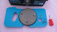
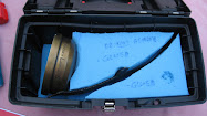
After removing the canopy and climbing out of the ship, I activated the message button on Glenn’s SPOT device. He had loaned it to me and explained that he had a pre-recorded message set up which would call his cell phone and report the coordinates of my present position automatically. I also checked the Alby SPOT device and saw that it was still functioning normally with both LED’s blinking properly. I then called Liz on my cell phone and found out that in spite of no radio contact, they had been following the Alby SPOT signals via Glenn’s I-phone screen and so were less than five miles from me and were on their way. Modern technology is truly wonderful, I thought.

I remember many occasions in my early years of cross-country attempts when I walked from my landing spot to some ranch house and used their telephone to call home, then waited hours, sometimes into the middle of the night for someone to come fetch me. In the mean time, I set about trying to find a gate that would allow access into the field. There was a house across the road, and while I was walking the fence line, a fellow strolled over and struck up a conversation. He hadn’t noticed the sailplane sitting in the field and said he thought I was inspecting the fence or something. I explained what was going on, and told him my friends would soon be there with the trailer. He said that he wasn’t the owner of the land, but knew Russell York, the man that was leasing it. In fact, he dialed Russell’s number on his cell phone then handed it to me.

I introduced myself and explained the reason for the phone call. He began to give me directions on how we could get into the field, but then decided it would be easier to just come on over and show us. A few minutes later, I saw Glenn and Liz arrive and shortly thereafter Russell York and a friend of his, Markeith Buckner showed up. Before long the whole convoy had come in through a neighbor’s pasture and a back gate into this field and pulled up to where the Libelle was resting. After introductions were made, we spent some time telling Russell and Markeith all about sailplanes, soaring, cross-country flying in general, and Alby’s Voyage in particular. They were fascinated with the whole project and we gave them information on how to check the past and future progress of Alby on the website. We also told them to be sure and look for this story to be posted because they were going to be included in it. Meeting helpful and friendly people like Russell and Markeith is one of the greatest parts of this whole adventure. Thanks again guys, for all of your help and hospitality!

Because of the lack of main wheel, we had to use a modified procedure to de-rig the ship. With the help of our new friends we wrestled first one wing then the other off and into the trailer. Then we all lifted the fuselage up and onto its’ cradle. It didn’t take long at all and we had everything secure and ready for the trip back home. We made it back to the Denton Airport around midnight and swapped the trailer from Glenn’s rig to mine. Alby and I were back at my house in Gainesville about an hour later.

***********************

Special thanks to Dean, Elizabeth, Glenn and Tom for their extraordinary contributions to these flights. Ed.

The Dallas plan

Note below is from Terry Stroud, volunteer and perhaps pioneer on the Decatur, Texas-to-Gilliam, Louisiana leg. We trust his skills and wish him well. Ed.

Alby watchers.....

Alby has landed in Texas, south of Dallas. After visiting with a new ground-bound friend (see picture) the talk turned again to flying eastward. Alby then learned that the next stage is something of an adventure, a journey into the unknown.

It turns out that while humans know all about (and travel all over) the land underneath the leg ahead, very little is known about the air itself. Just 20 miles east of Alby's location marks a point that human just don't normally go beyond. Unlike Alby, the humans use maps of the sky and "turnpoints" to navigate from place to place on the currents. "Turnpoints" are a kind of collective wisdom of the humans who have glided over these markers. "How is it around Kaufman?" they ask. "Not bad" says another. "Just stay away from the lake to the south." Just east of Alby, turnpoints do not exist. No one goes there. It is not impossible for motorless flight, it just gets so much harder.

The first difficulty, Alby learns, is water. Water and waves are friends Alby knows well, but on the big expanse of land, it seems that water can be an enemy to flying. Water from rivers and recent rainshowers have soaked the ground that lies ahead. The wet ground greedily soaks up the warmth of the sun and lets the air have very little of it. Also ahead is an obstacle not created by the earth, the water, or the air. Alby has experienced this strange obstacle before, this odd set of rules that govern the sky called "airspace." This time it lies right where the distance would be shortest, right where, indeed, the water can be avoided. The airspace can be traveled around but the price is longer distance and less choice of path.

There is no danger ahead, just study, trial, and perhaps error. Alby thus settles in with his next airborne guide to study the land, invent new "turnpoints", and explore the air that the human flyers know so little about.

A little about Alby's next guide....

Terry has close to 1000 hours in the air, and about 24,000 miles of cross country experience. He has flown a 2-33, a 2-32, a 1-26, a Grob 103, a Puchaz, an ASK-21, a PW-5, a Stemme s10, a Glasflugel 303, a Duo-Discus, an ASW-27, a 304S Shark, and currently owns and flies a Ventus Ca.

Alby flight No. 25 and pin No. 14- Elizabeth Maynard 7/25/09

Alby Flight No. 14 – Decatur to TSA

Two weeks before the Alby flight…


I must have had sunstroke because after three days of playing with airplanes and gliders in record high temperatures of 108F I announce that I will fly Alby from Decatur to TSA. I, who only got her gliding licence last September and who had never flown more than 16 miles from her takeoff airport, now thinks that flying 65 miles for a first cross country, over twice that required for the Silver distance, makes perfectly good sense. When I get home, I email Dean Forney, one of the most knowledgeable glider pilots I know, and inform him of my decision. “Go for it”, he writes back. I email Francis, one of the officers of our club, and ask her to let Sergio know. She does, but politely asks me “isn’t it rather like jumping into the deep end after just learning to swim?” That strengthens my determination to do the trip. I always rise to a challenge. So it is all set; everyone is informed. But by Thursday, when the sunstroke is fading and the reality of the task ahead is sinking in, I realise I must have been very ill indeed.

You may wonder what gave me the audacity to believe I am capable of such a distance with such little experience. Since buying a beautiful Russia (AC-4C) earlier this year I have wanted to fly cross country. I have been practicing all the exercises suggested by the experts. I have practiced flying small cross country triangles around Decatur. I have made many flights of over 2 hours and if other pilots can stay up, I usually can too. Through writing articles for my club newsletter I have spent much time considering landing out and cross country planning. I was beginning to feel ready for the club standard 35 mile jaunt up to Gainesville. Then along comes Alby.

One week before the Alby flight…


As Alby gets closer to Decatur, on the wings of Dean’s Libelle, I can see more clearly what I have volunteered for and I start to think I have made a really stupid decision. I email Sergio so no hopes will be built up. Two things I don’t tell him. Firstly, I will actually have to fly 85 miles around DFW’s class B airspace. Secondly, my small trip to an airport 16 miles away was actually at Moriarty on a day when other pilots were flying 500 km courses. His reply informs me many people will be following my flight. Secretly I pray for an internet meltdown.
One day before the Alby flight…

I had originally intended to fly to TSA in very loose formation with my good friend and gliding guru, Steve Altman. But as I watch the weather forecasts, it looks like I will be able to make the flight the weekend after Alby arrives at Decatur. I know Steve will be working then, so hope I can delay the flight until the following weekend. I meet up with Dean on Friday afternoon. He gives me a serious look over his café au lait. “Well, Liz”, he says. “It looks like tomorrow will be the best gliding day of the year”. I know I can’t pass such a day up and will have to make the flight without Steve. It will be just me and Alby.

The Alby Flight...

The most important things I take with me into the cockpit are three pieces of advice:
1. If you don’t want to deal with an emergency, don’t create one – Jim Vickery (He actually tells a short story, but this is the moral of the tale.)
2. Get high, stay high – Dean Forney
3. Only worry about the waypoint behind you and the waypoint ahead of you – Steve Altman


Launch No. 1:

I had arranged with the tow pilot for a 12 noon tow and things are going pretty much on time. I plan on sampling the conditions before I leave. I am not going if the conditions are not as good as Dean has promised. After releasing at 2500 ft AGL into a clear blue sky I find a marginal thermal that keeps me from descending, but doesn’t offer me any decent lift. But feeling it might grow into something bigger, I decide to work it for a while. Unfortunately it is in the power aircraft traffic pattern and, for the first time ever since I have been flying at this normally very quiet airport, three training aircraft simultaneously arrive to practice touch and goes. Floating 500 ft over them makes me nervous and I move off hoping to find another thermal. Nothing. Neither lift nor sink and I gracefully float back to earth.
Launch No. 2:

Despite the still blue skies, and despite two other pilots launching and finding nothing I relight immediately. I release into a strong thermal. It takes me up to 3200 ft AGL and then breaks up. I lose it, try to find it again, give up, try to find another thermal, hit sink, head back to Decatur, hit strong lift on final, deploy full spoilers and still need a slip to get down. I land and look up. Cumulus clouds are beginning to develop. High ones, with dark concave bottoms and well defined development. I run my glider backwards up the runway to get relaunched.

Launch No. 3:

A little before 3 PM I release at 2400 ft AGL, this time into a whopping thermal that drives me up to 7000ft AGL. I know this is it. Just to be sure before leaving Decatur’s airspace, I fly towards a neighbouring cloud and again, find 4-6 kt lift. No question, this is it. I radio to my ground crew, a.k.a. husband, to switch to 123.5. This is the signal for him to start driving south.
My progress is slow going. Firstly the winds are from the southwest, with a 10 kt headwind component. Given that the best L/D of my Russia occurs at 50 kts, my ground speed is unimpressive to say the least. Secondly, I am following Dean’s advice and staying high. Cloud topped thermals are abundant and I am able to dolphin from one to the other, straying only slightly off course. Occasionally I stop to thermal in the strongest for the pure joy of rocketing upwards at 6-10 kts. (You have to understand, here, 2 kt thermals are normal; 4 kt thermals are considered a treat.) In this fashion I am able to stay above 6000 ft AGL…until I get to Parker County Airport, a third of the way on my route.

Then everything seems to stop – the road I have been following, landmarks, the abundance of clouds. A few scraggy, poorly developed cumuli break up the blue, but these are miles apart (25 miles at my guess), far too infrequent for the glide performance of my Russia. I stop in a thermal just south of Parker County and try to squeeze every last inch out of it. Given that the southerly wind is blowing me back up my track, I know this isn’t a great idea, but I need time to think. Was I about to create an emergency? At that point my crew asks for my position. After I answer, a second male voice comes over the radio.

“Are you the pilot bringing Alby to TSA?”
“Yes,” I reply. “If I make it.”
“I’m the next Alby pilot,” he says. “And you’ll be fine. You’ve got a few hours left.”

For the first time I look at my watch. 4:30 PM. I have paid no attention to the time until now and it is later than I would have liked. I can feel panic seeping into my bloodstream. There’s no way I can do this, I think. It’s too late. There’s no lift out there. I’m doomed. And the internet meltdown hadn’t happened. I start irrationally veering off to the west towards a deceptively good looking cloud. Panic is beginning to affect my thinking. I kick myself as best one can in a small cockpit. I read Steve’s words in my mind – one waypoint at a time. I look south. I can see the bend in the east-west road that curves around Bourland airport, 11 miles away. I am at 6000 ft AGL. I have two choices. I can land now and end this anguish. Or I can just head out to Bourland. I have enough altitude to make it there. I will either find lift or not and once I get to Bourland I can re-evaluate my position. So like a diver jumping into the water, I hold my breath and turn south.

There is little I can do other than fly along like a blind man with a cane and hope I will bump into another thermal. I can’t reach any of the clouds and the ground is uniformly brown and barren, offering few clues about thermal generation. After only 5 miles a small bubble allows me a few turns and I gain a 1000 ft, and so pass by Bourland at 6000 ft AGL. Things are still not too bad. My next waypoint is Embry, almost 20 miles away, although there are a couple of landout airfields enroute if I need them. I fly in smooth air for 10 miles and then finally stumble into a moderate thermal that bears me back up to 5500 ft AGL. I continue on, my vario alternating between crooning and lazy chirps. Three miles later I feel something good. I turn but sink like a rock. I have just been tricked out of 500 ft. I am down to 4000 ft AGL. With one of my landout airfields almost under me I continue southeast, expecting that I will soon have to turn back and land there. I give it a thorough checkout as I fly by. This is where it will all end. The slow descent is like a slow death. Part of me wants to land and get the inevitable over with.

Some gentle lift tickles my wings. My vario chirps with a little more enthusiasm. I slow to milk this for all I can get. Then suddenly…Bam! A giant bubble of air slams against the underside of my glider. My vario screams like a hyperactive canary. I throw the glider into a 50o bank, drop the nose a couple of degrees on the horizon and kick the rudder to quickly get my nose around. There is no way in hell I am losing this one. And bingo, I hit the bullseye and ride 6 kt lift like an express elevator through 4000 ft AGL…5000 ft…6000 t then…

Ding.

My GPS gives me an airspace alert. The southwest wind has blown me uncomfortably close to the Class B. I have no choice but to leave and pick up a heading that will keep me close to, but out of the airspace. And so I learn a new definition of pain – leaving the only thermal this side of DFW while it’s still bubbling like the brew in a witch’s cauldron.

With enough altitude to continue on, I start looking ahead for Luscombe, my next landout field. I see it and it looks like a comfortable glide. I check the distance on my GPS and I notice that TSA is now within gliding range. I pause. I am surprised. I had been so sure I would be landing out I had forgotten about TSA. But now it slowly dawns on me I might actually make it and a small flame of hope ignites in the back of my mind.

I turn east. If I hit sink, I can still make Luscombe, but I find neither lift nor sink. For 15 miles, nothing. Absolutely nothing. Luscombe becomes an unreachable dot on the horizon behind me. My GPS tells me TSA is only 4 miles away. In this featureless terrain, I still don’t see it. I am at 2200 ft AGL and I can’t see the place I’m hoping to land at. It is disconcerting. But the numbers tell me I will make it, and I have no choice but to believe them. Still, I am picking out suitable fields as I go. I see a long whitish building and I remember a long hanger on the airport diagram on their website. That must be it. I head straight for it.

At a little after 6 PM I cross the centreline of the runway at 1600 ft AGL. I have little altitude to spare. I enter the traffic pattern and land. As I step out of the cockpit it occurs to me that if my life was a movie, at this point the orchestra would start up and I would give some teary speech about this being the best moment of my life. But, after hours of keeping my emotions under a tight rein so reason and common sense could prevail, I can only feel hunger and the need for the bathroom. We tow the Russia in. I wake up Alby who’s fallen asleep watching the barograph. After Terry Stroud lands, I pass Alby into his care for the next long and difficult leg of Alby’s voyage.


The day after the Alby flight…
My excellent crew and I sleep late, then treat ourselves to a leisurely breakfast. I am still exhausted, but Glenn needs to get his gliding fix so we head out to the airport, arriving later than usual. We are assembling the Russia when Dean drives up.
“Hey Liz,” he calls. “Everyone is waiting for you in the hanger.”
As I walk in I am greeted by congratulations and well dones from my fellow club members. Jim presents me with a bunch of flowers. Dean shakes my hand.
“Well done, number 14,” he says.
“Thank you, number 13,” I reply. I can’t help smiling. To hell with reason and common sense. This feels good. This feels really good.

Elizabeth Maynard

Alby flights No. 23 and 24 and pin No. 13- Dean Forney 7/19/09 and 7/21/09

Alby's Log, Leg #13: Littlefield to Decatur (leg one)

I met Steve and Reba Altman at the North Texas Soaring hanger in Decatur after I got off work Saturday. After looking at a couple of driving routes to Littlefield, Steve suggested we drive the one that was closest to the planned flight route so that we could study the terrain and check out possible land-out sites. We hitched up the Libelle trailer to Steve's truck and headed west at around 3 PM. We saw some vast areas of beautiful and colorful country. We saw some vast areas of ugly land-out possibilities. When we arrived in Littlefield, we drove out west of town to find the airport then checked in to the newest and nicest Best Western Motel in town. The lady at the desk gave us directions to a great authentic Mexican restaurant where we enjoyed a great meal. The forecast for Saturday was for a 40% chance of thunderstorms. As we left the restaurant we were treated to a spectacular display of lightning and could see the glow created by a large field fire caused by lightning strikes. I think all of the 40% thunderstorms hit Littlefield overnight; the other 60% went somewhere else.

The plan was to get an early start, utilize the legendary west Texas thermals to climb somewhere up in the teens and then cruise east 280 miles and land back home at North Texas Soaring in Decatur.

Take-off from Littlefield 12:35 July 19

I got off the ground a little later than planned, but as it turned out; it didn't much matter because the legendary west Texas thermals were late starting. I got off tow at 3000 AGL west of the airport and in dead air. I could see that most of the flat fields surrounding the airport were pretty wet. I found the first thermal just east of the airport, and it was not legendary. Due to the wind being around 20 knots out of the south, it leaned way to the north and was scrappy and fell apart just before getting back up to tow release altitude. I decided that the best bet would be over town where there was some dry asphalt and dry roofs to maybe generate a legendary thermal or two. There was a huge black field south of town, the one that burned up the night before. It consistently kicked off thermals but they were still the non-legendary kind that leaned over and fell apart at 28-2900 AGL. For almost two hours I kept grinding my way across Littlefield, circling and drifting north, gliding back south to start over again. I bet the folks that live there are still talking about it.


My plan at this point was to just keep sampling the thermals, wait it out until one of them became legendary, then head east. Finally I was getting a little higher, maybe 35-4000 AGL and then Steve called me and said he and Reba were about 10 miles out of town and were waiting to see what happened. They said I answered by saying something like "ummm, wellll ok, guess I will head out too". So I headed pretty much due east for my first checkpoint which was the town of Abernathy. Tom Pressley and the guys at Caprock Soaring had told me that if I stayed north of Abernathy I would be safely out of Lubbock's class C airspace. It actually wasn't that bad. The thermals were regularly spaced and gradually were getting a little higher, but still costing me in a lot of drift across course while climbing.

After clearing Lubbock the plan now was to just keep pushing east, correcting for the relentless wind drift and staying as close to course as possible. Slowly the checkpoints of Cone and then Crosbyton slipped past my wings. There were some medium high cloudstreets every now and then, but they all ran north-south and were spaced about 20 miles apart, and they gave up altogether as I approached the edge of the Caprock, where the elevation of the terrain drops off fairly quickly from 3500 MSL to 1500 then 1000. This is also where the badlands start and where there is 40 mile stretches of unlandable stuff. Just before leaving the high country, I finally found a couple of almost legendary west Texas thermals, showing 8 knots to my highest for the day of just a tad over 9000 ft.

For the most part, I was staying high enough where I could see landable fields scattered around the badlands within reachable distance. By that I mean that with the use of a thermal or two I could reach them, and failing that, I could leave course and head over to the highway where Steve and Reba were going east, and land there.

The only bad period I had was caused by a tactical error. After heading out off the Caprock with a comfortable amount of altitude but over the longest stretch of bad terrain for the day, I could see a very large blue area which no doubt contained a lot of sink and not much lift. North of the highway about 20 miles or so is a string of huge wind turbines and I could see several areas of flat farm fields scattered around them. There was also a few cumulous clouds there so I decided to veer off course and go around the blue hole. You know what happened next. The closer I got to the clouds the more ragged they became until they completely dissipated. Now all I found was sink and lots of it. The blue hole was pushed north closer to the wind farm and some better looking stuff had drifted in behind it. I turned back to the south to get out of the sink and surveyed the situation. I was within gliding distance of the highway about 15 miles away but didn't have enough altitude to get to the east side of the badlands. I headed a bit to the east but mostly back to the highway. About three miles north of the highway and 2500 AGL I found a fair thermal and climbed back up high enough to continue east to some landable ranchland. If I had just continued on course but aimed into the wind, I would have been able to skirt the south edge of the poor stuff and saved a lot of time and gained some extra miles as well.

Next checkpoint is the famous 6666 ranch. Pioneer oilman Amon Carter won the ranch in a poker game with a hand of 4 6's. It covers almost all of a very large Texas county and is still owned and run by his heirs. It is out in the middle of nowhere, folks. There is a world class paved and lighted runway adjacent to the highway on which family and friends come in their biz-jets. The ranch complex looks like a well maintained small town. I am told that they frown upon people landing there without a really good reason to. It looked like mine might be the classic glider pilots' reason: the wind quit, or least that was what I was going to have to make the ranch hands believe was my excuse.

Steve and Reba were parked in the shade of a few Mesquite trees at a rest area a couple of miles west. I could plainly see them sitting there. I was finding a thermal every now and then, and while I wasn't getting very high I was encouraged to keep pushing east. By this time the day was waning, and I was finding lift was topping out around 4500 or so, but it was still there so I kept on marching along. The next checkpoint was Munday and as I was getting closer to it, I could definitely feel that the day was almost done. There is a nice airstrip at Munday, but to go there I would need to deviate south of course by about 5 miles. On the other hand, the airport at Seymour requires that I go north of course about 5 miles but puts me further east and that much closer to the goal at Decatur. I could actually see what I guessed were water towers and grain elevators way off to the east, and thought that must be Seymour. I am 22.8 miles away and not high enough to make it. Just then I ran into the last thermal on earth for this date, and thankfully cranked around into it. It was a nice ol' thermal and by hanging onto it and milking it, I managed to get just a bit over 5000 ft and earned a nice final glide.

I arrived at Seymour with 700 AGL and entered a right hand pattern and landed to the south. Steve and Reba showed up about 20 minutes later (they had gone to Munday earlier). We had planned on leaving the Libelle tied down overnight, but after remembering what it was like at Littlefield the night before, and also seeing a big black wall off to the North West, I decided to de-rig and put the Libelle back in the trailer. We parked the trailer between two hangers and hit the road for Decatur. I was proud of my old ship for doing such a good job on such a challenging day, proud to get Alby moved on 180 miles closer to the sand dunes at Kitty Hawk, and extremely proud of and thankful for Steve and Reba's support. I would not have been able to make this flight without them. It is such a great relief and boosts your comfort level tremendously when you have a crew supporting you from ground level, and especially when you get the expertise and advice of a super CFIG like Steve Altman thrown into the bargain.

Thank You, Thank You, Thank You.

View Flight on OLC


Alby's Log: Leg #13, Littlefield to Decatur (leg two)

At my home in Gainesville I woke up to the sounds of thunder and heavy rain. This was the next morning after landing at Seymour, and I had planned on finishing Alby's Voyage to Decatur today.

Late night phone calls from Steve Altman and me to Francis Berryhill and Jim Vickery, the ramrods of our club, North Texas Soaring, had placed the next phase of this adventure in motion. Steve and Reba would not be available to continue crewing because of work schedules, so it was arranged for Glenn and Elizabeth Maynard to take over. Towpilot John Thomas quickly rearranged his work schedule at Lockheed so he would be available after noon.I got a phone call from Glenn in Denton where it was also pouring rain, and he asked me if I was optimistic about the chances of making the flight. I had just checked Dr. Jack's Blipmaps and my interpretation was that the flight could be done if the rain quit early enough. The weather forecast was for the same thing for the next three days, chances of thundershowers in the AM and clearing in the PM, with 15 to 20 knot winds out of the north. I told Glenn that we should go for it, so he and Liz met me at the North Texas Soaring hanger in Decatur at 10:30 AM. It was still raining, and radar showed solid thunderstorms all the way to the Red River north of Wichita Falls. Glenn suggested we adjourn to Starbucks for further consultation, so we did. I called John at work and advised him that we were on hold for now. Finally the stuff began to dissipate and move off to the south, with clearing coming in behind it, but by now it was 12:30 and I could see there was quite a bit of high cirrus coming along behind the thunder cells. So the game was called and rescheduled for Tuesday. We all went home.
The next morning the same thing happened, woke up to the sounds of Thor slinging his hammer around the skies and rain pouring down at my house. Weather radar looked about the same as yesterday, except it looked like it might move out earlier this time. Dr Jack's Blipmaps didn't look as good because of expected winds tearing the thermals apart. Still, it looked possible, so I had my breakfast, kissed Sharon and granddaughter Sydney goodbye, and headed for Decatur. I got there early enough to get our good old Agwagon ready for John. Put a tow rope in, charts and jumper cables just in case and she was good to go. Glenn and Liz showed up shortly after that, and after a final phone call to John in Ft. Worth telling him it was a go, we were off to Seymour. I must say that as far as crews go, Glenn and Liz showed every bit as much hospitality as Steve and Reba had. They continually offered me goodies like Starbucks high octane brew and deep fried stuffed Jalapeño peppers. As we drove on through Bridgeport, Jacksboro, Olney and into Seymour we constantly were looking for and grading potential land-out fields along the way. I was encouraged to see small cu's developing but wished they would get up higher. They appeared to be 2000 to 2500 at this time.We had just arrived at the airport in Seymour and hooked the trailer up when we heard the Agwagon coming and saw John enter the pattern. He landed just in time to help rig the Libelle and it didn't take much time at all before we were all set to go. The wind was blowing straight down the runway out of the north and the windsock was standing straight out.
The plan now was to take a tow, release west side of the airport and see if the thermals were holding together in the stiff wind. The plan was to use the plentiful cu's for markers along the route, staying as high as possible below cloud base which was at this time, less than our planned 3000 ft tow.The first thermal I got into off tow was a good one, held together OK, but Oh My Word! You talk about wind drift. The airport is about 4 miles north of town and as I circled in the lift I crossed the town north to south in a matter of minutes. Now it was time to get to work and get moving along course. Because I couldn't get high, I flew from cloud to cloud in a zigzag fashion. I would fly at about a 45 degree angle between course and wind direction, aiming at the next best looking cloud upwind. Almost every cloud I came to was working so I would take as many turns as I wanted in the good stuff, and just dolphin through the mediocre ones. While circling, the wind would shove me south and then I would head out northeast and repeat the process. I could see that this was not going to be a record breaking pace as the lightning bolt shaped course was netting me just about half of the groundspeed I would have achieved with no wind.
Even so, it was so easy that I imagine a Caveman could do it. Cruise at about 60 - 65 knots, climb under any cloud you want, push it a little faster through the occasional sink between and next to clouds, don't get too low, repeat process. I caught sight of Glenn and Liz twice along the way. They had no trouble keeping up with my pace, even though Glenn had to stop at every Dairy Queen he came to and get some more of those Jalapeno Poppers.It even got easier for a while because cloud base had crept up a bit during the strongest part of the afternoon, and the wind speed had eased off a bit as I got further east and south. Along with that, however was the fact that overall conditions were softening. As the sun moved lower toward the horizon, the wet ground and milder temperatures became more of a factor. After the flight, Liz told me from the ground it appeared as if the Munching Critters from a PacMan game were gobbling up the clouds after I used them, and they were gaining on me.They finally caught up with me about the time I came to the Bridgeport airport and began to eat up the clouds ahead of me as well. It was about this time that Alby and I began to have chats. He would say "Dean?" "Yes, Alby" I replied. "Are we getting in trouble here? It seems that we are just going around in circles and not gaining any altitude" "I agree. The day is dying so fast that I'm beginning to wonder if we may have to land." "Dean?" "Yes, Alby" "How much more do we need?" "Alby, if I could just find one more thermal, we could make it." "Dean, there are three of my Turkey Buzzard cousins, climbing rapidly, over there about 3 miles south of us. I'm sure they wouldn't mind if we went over there and used some of it." "Good idea, Alby. Let's go for it!"

Alby is one smart bird! Even though his cousins did mind (they ran away as soon as the big bad Libelle started circling with them) there was a brief period where one of the Buzzards was circling off our wingtip about 100 feet and watching every move we made. It was great, got us back up to about 3700 agl and was good for a pretty fast dash home the last 15 miles.


Once again, Kudos and more for the crew(s). Thank you all so very very much for making this truly wonderful adventure possible. Jim, Francis, John, Elizabeth, Glenn, Steve, Reba, and the guys at Caprock Soaring.

Thank You All. Dean Forney

View Flight on OLC

Alby flight No. 20 and 21 and pin No. 11 - Ted Wagner 6/25/09


All:

Three and 1/2 weeks after his outstanding near-700 km flight from El Tiro, AZ to El Paso, TX, Ted Wagner returned to El Paso by car, with his father, Roy, as crew, and today successfully flew with Alby "180 miles east, to land in the next state west of Texas" in Hobbs, NM.

See his flight report below.

Ed.

Alby’s Log: Leg #11, El Paso to Hobbs

Thursday. 25 June, El Paso
7 AM

The day begins at my Tia Loca’s house, 5 miles from the airport, with a breakfast of fresh (and I mean fresh) eggs, toast and bacon, followed by a quick check of the weather. It looks promising, with cloud base above 13k the first half of the flight, dropping to around 12k on the second half. An east wind is expected.

The flight plan consists simply of staying high enough to always reach one of the four points on course – Horizon Airport, Dell City, Carlsbad, and Hobbs Industrial, each about 65 miles apart. If I can get to 12k at the right times, there should be no problems. The “nail biter” legs are the last two, which feature absolutely nothing but lunar landscape in between. To up the chances, I had decided to fly with 18M wings when we rigged Wednesday afternoon.

At 8:30am we arrive at the airport to fill the glider with water, wipe her down and finish all preparations. Lunch at 11am. My father Roy is crewing and he hits the road to Carlsbad at 11:20.

Alby and I see CUs to the east, and wait for them to get closer…

12:10 PM
After watching the CUs 10 or so miles to the northeast develop but not get closer, we decide to launch and go for it. The EPSS Pawnee, 68V, clears the end of the runway at 12:15. We release at 6500’ (2500 AGL) in 6 knots up directly over the airport and that takes us to 9200’ before topping out. Good enough to head on course!

Ten miles later at 7300’ we get to the CUs. They’re not working great, but they’re working, good enough for 11,500’ and we continue on course ENE in the direction of Dell City. The sky north and east looks good (actually, great!), about 20% cloud cover with some patches of blue here and there. The wind is stronger than the forecast and out of the ESE, making for a 12-14 mph nose wind.

1 PM – 1:45 PM
On course to Dell City features lots of good looking clouds but few of them working very well. At one point, down to 9200’, I divert north to a good looking cloud where excellent lift takes us to 12k. (The first half of the flight has lots of diversions like this, not all of them as successful.) We get to Dell City around 1:40pm at 10.5k, with a desolate looking landscape, punctuated by the Guadalupe Mountains, to the ENE.

At this point I’m finally able to make my first contact with Roy after several tries, who reports passing through Carlsbad at the time, a good 60 miles ahead of me.

We continue across a blue hole toward the mountains at zero MC, slowing or stopping for every indicated lift, to make sure we make it to the next clouds in good shape. One thing I absolutely want to avoid is having to divert back to Dell City!

But the clouds over the mountains don’t work very well and we find ourselves nursing a marginal glide to Cavern City, the next waypoint, while constantly checking the glide back to Dell.

2:15 PM
Below 10,000’ and still 26 miles from Cavern City, still conserving a 1500’ over 0 MC glide there, we decide to divert southeast to a very good looking cloud over the high ground west of Whites City. Green fields are visible there, should the worst things happen (and since they can, that’s what we prepare for). The cloud works great and we’re back to 12k, now with Hobbs dialed in.

It seemed like very slow going up to this point, with generally weak clouds and that pesky nose wind, but the computer says we only need another 5000’ to make it to Hobbs.

But from the cloud southwest of Whites City for the next 40 miles, it’s more of the same Cumulus Suckerus. I think the lift in the blue is better than the clouds! During this portion of the flight we are still in reach of Cavern City, but below 9000’ with the caprock a few thousand feet below, I’m really hoping to find a payday thermal. Ten miles northeast of Loving we see another great looking cloud and after a few minutes finding nothing, we try the much smaller cloud to the south and that one works great!

3 PM
Back up to 12,200’, and the LX7007 says we have glide to Hobbs if we don’t fly too fast.

And wouldn’t you know it, as soon as glide to the destination is achieved, the going gets easy! All the way to Hobbs, every cloud works, some of them fabulously. At 3:15 we start a 50 mile glide that puts us over Hobbs Industrial at 11,700’. Onward to Denver City, another 26 miles northeast.

This part of the flight isn’t necessary of course, but I can do it while keeping plenty of altitude to still make Hobbs. I wasn’t going to pass up the opportunity to visit the resting place of my mother Rose, who we recently laid to rest in the city where she grew up and met my Dad in 1956. I pick up the cemetery just before 4 PM and do a wide loop around it with the dump valves open, a ceremonious watering of the grass, and I thank Alby for indulging me.

Still lots of altitude at this point so we race back to Hobbs and arrive there with 1500’ to spare. After landing, we can declare that we flew 200 miles almost due east and landed in the next state to the west.

A wonderful day! I hope the next pilots to escort Alby across the country enjoy doing so as much as I have.

-Ted/2NO
Alby pins #10 and #11


View Flight on OLC

Alby flight No. 19 and pin No. 10 - Ted Wagner 5/31/09

Sunday, May 31st7:30 AM
The day starts early with a check of the weather and preparation of new turnpoint databases for the PDA (running WinPilot Pro) and LX 7007. (This step I managed to overlook before the previous day's attempt, though when I started that flight I knew I could select a new database on the PDA in flight.)
To get the same database in both instruments, I loaded the ASA and El Paso turnpoint files in SeeYou, deleted the non-landable points, and saved a geographic subset of the remainder to WinPilot (dat) and LX (da4) files in turn. I was thankful that Alby reminded me to do this today. Smart bird, he.


Alby admires the eastern sky from his steed prior to Saturday's unsuccessful flight. El Paso is 305 miles thataway.

In addition to weather checks on xcskies.com and drjack.info, Cliff "CH" Hilty, Alby and I spend a little more time planning the possibility of getting to Alamogordo or even Moriarty. We decide that if (1) Alby and I make it to Deming early enough, (2) Albuquerque Center clears us to fly through the R-5107 (White Sands Missile Range) restricted airspace, and (3) the weather that direction looks good enough, we will divert northeast to attempt one of those alternate destinations.


The flight plan, as far as landable turnpoints to El Paso goes, consists of Cascabel, Willcox, Lordsburg, Deming, Dona Anna, and finally Horizon Airport (formerly West Texas Airport, on the east side of El Paso).

9 AM
Did I say the weather forecast was good? Mike "WA" Stringfellow stopped by during the wipe down to brief us. "There's good news, and interesting news," he said. "The good news is that today looks better than yesterday. The interesting news is that the low pressure system stalled in a position to bring in more moisture on your course line than was previously expected. Look for CUs over most of New Mexico." That was great news!By 10:30a we have the glider ballasted (45 gallons), programmed and ...

11 AM
All systems ready for launch! I am feeling both nervous and optimistic. (A few extra butterflies because this flight brings back some rich memories of an identical flight I did from El Tiro to El Paso on June 5th 2004, almost exactly 5 years earlier. It remains the only straight-out goal I've ever attempted, and I was about to try it again, but this time with better weather, a better glider, and no excuses!)

11:30 AM
Giddy-up! I slap Cliff's horse on the flank and send him on down I-10.
11:52 AM
Alby and I launch at El Tiro. Three minutes later I release in 3 knots at 2600 AGL. The sky to the east is mostly blue but well to the northeast some white puffies are visible.

After reaching 9000' (the field elevation is 2100') I flew west to find something over the higher ground nine miles from the field. Halfway there I stopped to turn in a few knots, and when this was suddenly disappearing after only 1000' gain, I spied some dust devils on course eight miles to the northeast. I pushed the nose down and connected with the first of them. That got me to 11,500' and from there I headed toward Mt Lemmon, 35 miles east. Some CUs were showing up just northeast of there.
12:48 PM
We arrive south of Mt Lemmon at 9k, just below the peak. The lift to this point has been marginal, but then the day is still young. At this point in the flight the goal is to find the higher lift around Mt Lemmon to get to Cascabel, 30 miles east. With the wind coming from the SSW, I search along the Pusch Ridge southwest of Mt Lemmon for some adiabatic lift, and find some, eventually working it to 12,500'. This is good enough for a glide to Cascabel, so off we go. Still solid blue, but I can see CUs forming way to the north and east. I hope my kindred spirit Alby is enjoying this as much as I.
1:15 PM
After a long, sink-riddled glide to Cascabel (a remote dusty strip by the San Pedro River way out in a place you absolutely have to be going to to get to), I finally hit a few knots at 8500'. (I was thankful not to be nearly as low there as I was five years earlier, when I caught a butt-thumper at pattern altitude above the strip.) Ten minutes later I resumed course at 13,000'.

The clouds to the north and east look like they were getting farther away. Cliff, who is well ahead of us on the east side of Tucson, reports CUs north of Willcox and lots of dust devils by the freeway.

On course to Willcox I stop in just about all the air I encounter that's going up. The day is still young and landout options far between, so I don't take any chances, especially with CUs visible (maybe 50 miles) to the east.

North of Willcox I'm finally up to 14,000' and now confident that the day will end at one of the three planned destinations.
2:25 PM
After an hour and ten minutes of glide-and-turn in blue but strong skies, I finally reach the CUs twelve miles north of the ghost town of Steins. The first one is a dud but the second one is decidedly not - 9.2 knots to 16,600'. This flight is now in the serious No Excuses stage. I hear Alby telling me how much fun he's having, and how beautiful this part of America is. I say yes, I agree, but it's even more beautiful from this altitude!

I curse myself, yet again, for forgetting to pack a camera in the cockpit.
3 PM
I call Albuquerque Center and ask about the R-5107 (White Sands Missile Range) restricted area. Will we go toward Alamogordo (and possibly Moriarty), or continue to Texas?

Some very thick cloud cover to the north and east has me slightly concerned about the weather that way. Alas, Albuquerque Center reports that the R-5107 is hot. (The tone in his voice suggests that it's a dumb question - "Eh? It's always hot!" is the message I get.)
So, El Paso here we come.
~3:30 PM
(Conversation overheard in cockpit)
What's that over there?
Alby, that's the Deming Aerostat. Ask Randy Acree about those. No, we're not going any closer.
Why did you stop turning in that thermal? Dude that was like 14 knots and you just waived it goodbye.
We have an altitude limit, my friend. We can't go above 18,000', and to play it safe we absolutely stay below 17,500'.
Cool! But this is still the highest I've ever been.
Yeah, I bet you tell that to all the taxi drivers. And yes, it's cool, I'm freezing my toes off!
Can I have a bite of your apple?
No. I'll explain later.
What are those big round things down there?
Cowboy hats, Alby. Welcome to Texas!
4 PM
We cross the border into my home state of Texas at 16,000'. At this point I have enough altitude to fly well over the El Paso Class C, but to play it safe I skirt the perimeter around the north and east side. (Horizon Airport, formerly West Texas Airport, is tucked into the east side of the Class C, just west of the city of Horizon.)

Exactly as the forecasts predicted, the sky to the east of El Paso looks lower and less organized than to the west. Cliff reports that the Garmin nav is showing a 5:30pm arrival time at Horizon Airport, so to kill time, I head southeast in an attempt to pick up a cloud street following the line of the Rio Grande starting around Fabens, about 25 miles away. This is the worst leg of the flight! Nothing but down, down, down until I turn around before losing my ability to land at Horizon. Just before getting back to Horizon I find some lift to work back to 12k.
6 PM (local - now an hour later than AZ)
With Cliff still a half hour out, I head to a street to the northeast, and this one works much better. Thirty miles later I turn around to head back and call it a day. Alby says he's hungry, what's the possibility of a real Texas steak for dinner? I tell him, "pretty darn good, pardner. You'll like it better than the fish those Californians have been giving you! Better than any apple, too."

7:07 PM2NO and Alby full stop at Horizon Airport


As promised, Alby gets a steak dinner at the famous Cattleman's Restaurant (which is a turnpoint in the El Paso database!). The wine is Bin 38 - a very fine 2002 Châteauneuf-du-Pape Grenache Noir. If you think that sounds good, you shoulda tried the 10 ounce aged filet!


9 PM
Alby says goodnight with a Thank You to Sergio for organizing his journey across this great country of ours. The El Paso club doesn't do much cross country (not surprising, being boxed in by the Class C west, Mexico south, R-510x north, and the next landable point to the east just short of San Antonio!), so hopefully someone from Alamogordo or even Moriarty will be able to trailer down and fly Alby to his next destination.

Alby, CH (pin #9) and 2NO (pin #10) at the Cattleman's Steakhouse


View Flight on OLC
Alby in the News

The flight of the Albatross across our Country caught the attention and the fantasy of a newsmaker, Adam Breen, who published a well written and inspired article in Hollister's "The Pinnacle" newspaper: www.pinnaclenews.com/news/contentview.asp?c=255106

Alby's Story

Alby is a Laysan Albatross. He was born and raised in the Midway Islands, not far from the very same Laysan Island that gives names to all the individuals of his species. His parents fed him for six months. They alternated trips of one or two weeks, during which one of them was feeding and the other was protecting Alby and the nest. The long intervals were necessary because often the food was very far away, up to 400 or 600 miles away. They fed him until he became as big as them, and then suddenly deserted him. They did that because they instinctively knew that he was developed enough to take care of himself from then on. And they could not spend all their energies in raising a chick. Although they can live 40 to 60 years, they can only raise a chick every couple of years.

The young albatross did not know all the tricks of life at sea, and the first year he had difficulties at times. One half of the fledglings do not make it through the first season, but Alby did, and everything was much easier after that. He went out on the open ocean and did not come back for years, not touching land at all, living off the bounty of the ocean, sleeping on it, learning to travel using the wind forcing the air up against the moving ridges formed by the waves.

Alby came back to his native island when he was three years old, because his biological clock was giving him the urge to look for a mate. His tentative dances with prospective mates were as clumsy as those of the other young albatrosses around him. Naturally nothing happened, but he experienced and practiced the ways of the elders.

He is 4 years old now. He has wandered the ocean all this time. He has gone through the vast expanses of water finding food, freedom, and safety. He has gone to the north Pacific and flown around the Aleutian Islands and the Gulf of Alaska and the fiords of British Columbia. Next year he will try again to go back to his birthplace to search for a mate, and probably will find one.

Albatrosses are at home in the open ocean, keeping at least 30 miles offshore. But Alby is different. He is curious about the land, just as curious as a young soul can be. In his voyages near the northern seashores he watched eagles fishing for salmons. That was not his preferred food, but he looked with interest at this different method of fishing. He communicated with the eagles, answering their whistles with his screeches.

He is fascinated by the land, but unable to penetrate it - he is used to mastering the wind over the waves, and the different way of flying inland is unfamiliar to him. He asked Eagle about the extent of the land, and Eagle said that there is land up to the summit of those far away mountains to the east, and more.

One day he met Pelican, and while they were floating and chatting over the gentle waves of a mild afternoon he learned that Pelican had actually been inland while flying with his flock. He had flown across the fertile valley of California, and over the magnificent mountains of the Sierra Nevada and farther more to the northeast. Alby learned that inside the land, beyond those far away mountains, there is a great lake, and peaks with snow, and forests and valleys, and towns and people.

Pelican described the beauty of the land, which is called America, according to what he heard when people talked about it. Being a sociable character, when he was inside the land Pelican also had contacted other big birds and knew a good deal about what lay farther inside that large country.

Pelican learned from the other birds that there are large deserts and arid mountains in the interior highlands. There are very few people in those deserts, few roads, few machines. Nature is mostly untouched by man there, with many animals running free. The air is not disturbed by artificial smells and mechanical noises. It takes many days of overflying this natural environment before reaching the majestic mountains of the Continental Divide. Here the land is green again with large forests. Snow may remain up to late summer, the rocks are harsh and austere.

From there one can overfly the vast farmlands that gradually decrease in elevation until they make room for the mighty rivers that cut the America land in two. Pelican had also contacted seagulls that told him about more land to cross going east, with plenty of houses and towns and people. There are cities sporting very high buildings that tower up toward the sky. There are rivers and lakes where an aquatic bird can feed. He heard tales from vultures and hawks that there is another long range of lower mountains and beyond that, couple of days away as the crow flies, there is ocean again.

Alby would like to go inland, see the beauty of the country, but he is not fit to go there. He does not know how to master the thermals the way eagles, pelicans and other birds with big wings travel there. He is made for the ocean.

Still he would like to go and try to cross this enormous island that he cannot cross, and get to the sea on the other side.

One day he flies along the shore, and sees some very big wings flying along the cliffs of the big town called San Francisco, as he understands people call this place.

Approaching those big wings, he realizes that there are people hanging on them. He discovers then that people cannot fly on their own, but have created artificial wings that support them. He knows what they are doing; he knows how to fly along the cliffs. He knows that, ‘cause such was the very kind of flight he took when he left his nest for the first time.

Soon those cliffs become a favorite place for Alby. He flies there often and so close to the flying people that learns many of the words they speak. He listens and learns that there are even bigger and faster flying machines with long wings for the people that like to fly like birds, which are called gliders or sailplanes. And there are flying crafts with propelling engines, capable of transporting many people at high speed. He understands now what are those enormously high flying machines that cross the ocean, so high that he barely can hear their sound through the whistle of the wind.

The flying people are impressed by the unusual behavior of this albatross, which so often flies with them instead of flying far away in the ocean like others members of the same species. They imagine that Alby wants to travel ashore, but does not trust doing it by himself.

The soaring people offer to take Alby inland, and to show him the beauty of the countryside. They offer to take him aboard their flying machines and let him cross this big island in silent winged crafts, no noises, no vibrations, no offending gas smells.

Alby accepts the invitation. He wants to see the mountains, the valleys, the lakes, the deserts and the forests, and the towns and the towers, and the roads and the bridges and the rivers of this beautiful land called America. He realizes that it is not possible for him to travel here alone, without the help of the flying people.

So the soaring people take Alby in their silent aircrafts across that vast territory. They understand. Because they themselves share the curiosity, the need for adventure, the thirst for knowledge of that young spirit. They share the independence that flying gives, the endless autonomous decisions that need to be taken in this constantly moving environment. They know the far-reaching view that this privileged position allows. But most of all, they share the elation of infinite freedom by being immersed in the sky, floating, suspended in the brilliance of this transparent ocean. Those are the reasons why they aimed for the skies, and now they cannot live any more without the magic of flight.

They take Alby with them, in the togetherness that unites all aviators. Alby’s great voyage has just begun.


Rules

ORGANIZATION OF THE VOYAGE

This website is recording the flights of Alby, his whereabouts and his flight log. The webmaster of the site is the Albymaster. All news and inquiries about Alby will be handled by this site.

Alby wishes to soar across America. He wishes to see it all, from the Pacific Ocean to the Atlantic, and then resume his wandering life across the seas.

Alby flies only in aircraft that use the energy contained in the atmosphere as a means for traveling. Motorgliders can use their engine only for taking off.

A proposal to fly with Alby shall be sent to the Albymaster. A proposal shall include a pre-declaration of the proposed flight.

Preference will be given, in order, to the site that is closer to Alby’s current location, to the first proponent in order of time, to soaring clubs or associations, to groups of pilots, or to an individual pilot. This means, for example, that an individual pilot has to wait for the soaring club to fail its attempt, before making its own attempt.

A club or pilot that has proposed to fly with Alby and has been accepted by the Albymaster, will be called the Albypilot. When a proposal is accepted, the flight should be made before the end of the next Friday.

If no other Albypilots have made the flight on their assigned week, the hosting club or pilot will have the right to make the flight before the end of the next Friday. If the host did not propose or is not able to make the flight, the next Albypilot shall make the flight before the end of the next Friday. And so on.

RULES FOR THE FLIGHT

Gliders can be towed to an altitude not exceeding 3,000’above take-off. Motorgliders will shut off their engine before that altitude is reached. The release or engine shut-off point shall be west of the take off field.

Each landing point will be to the east of the take-off point. If difficulties arise, an occasional back leg may happen, when accepted by the Albymaster.

The flight should end in a soaring site, or a place from where a glider can be towed out. If the flight does not end in the pre-declared location, the Albypilot or a pilot of the same club still have to the end of the next Friday to try and complete the flight as declared. If the pre-declared location still is not reached, Alby must be taken back where it started (not necessarily by flying).

Both the current host of Alby and the new host shall communicate the outcome of the flight to the Albymaster.

If the flight cannot be made before the end of the next Friday by the first Albypilot, it is the responsibility of the first Albypilot to give notice of the inability to make the flight, with timely courtesy, to the Albymaster, to the host, and to the second proponent in line.

The Albypilot who flies with Alby is responsible for keeping good care of him. When the Albypilot represents a soaring club or association, the representative of the club or association will be responsible for the well being of Alby.

The above rules may be superseded by the Albymaster when atypical circumstances arise.

Order of Preferences:

1 - The club that is closer to Alby’s current location
2 - The club that proposes first in order of time
3 - Clubs, soaring associations, soaring centers
4 - Group of pilots
5 - Individual pilots

ACCESSORY RULES

When start altitude, release to the west, landing to the east are difficult because of special local conditions, an exception may be requested to the Albymaster.

When an Albypilot cannot make the flight in the week he/she has been assigned, another Albypilot can make the flight provided he/she has been accepted by the Albymaster.

LOGBOOK, LAPEL PINS, SPOT DEVICE, GPS TRACE

LOGBOOK - Alby travels with a logbook. The Albypilot will fill out the log entry and sign it. The flight data will be e-mailed to the Albymaster and an entry will be placed in the website logbook. A description of the flight and pictures may also be sent along with the flight data, to be posted in the website. Enter all flights, successfull or not.

LAPEL PINS - The Alby case contains lapel pins. The pilot(s) successfully accomplishing a flight will get one pin each. The lapel pins are numbered. Check in the log book for the last pin number and take the subsequently numbered pin(s). If the flight is not successfull, place a bar in the last column (Pin No.). Please guard carefully the pins, we do not want them to misteriously disappear.

SPOT DEVICE - The SPOT device is to be placed in the glider in a place where there is sufficient visual contact with the outside (inside a shirt pocket is OK). It is to be used during the flight and placed in Alby's case when not flying. Instructions for use are in the case.

GPS TRACE - Pilots are encouraged to send their GPS log no matter how successfull the flight, as it will be posted in the map (flying with Alby is already a great success, to be recorded and displayed). Alternatively, it can be downloaded to OLC.

DISCLAIMER

Pilots who participate in Alby’s voyage acknowledge that it is a voluntary effort, and that the timing, route selection, weather decisions, and all other aspects of the flight are the sole responsibility of the pilot in command of the aircraft in which Alby is transported. The Organizers of Alby’s voyage, retain all rights to the concept, images, logbook, Alby trophy, and eventual chronicle of the journey, but neither they nor volunteers involved in the project nor the Pacific Soaring Council (PASCO) nor the Soaring Society of America (SSA) are in any way responsible for the decisions of the pilots that carry Alby in their aircraft. When pilots propose to carry Alby on part of his journey, they warrant that they have sufficient experience and will exercise all due caution to ensure the safety of their flights. By allowing pilots to carry Alby, the Organizers of the Alby project are merely keeping track of and attempting to facilitate the continued progress of Alby’s voyage.

WAIVER AND ASSUMPTION OF LIABILITY

Please accept me as a participant in the Alby voyage. In consideration of acceptance of this entry, for myself, my heirs, executors, administrators, personal representatives, successors or assigns I hereby release and discharge the Organizers, The Pacific Soaring Council (PASCO) THE SOARING SOCIETY OF AMERICA, INC., and their agents, representatives, employees, successors or assigns from any and all claims for damages or injuries suffered by me or by any member of my crew during the aforementioned soaring venture.

I further agree to assume full responsibility for and to indemnify, defend and hold the aforementioned entities and persons harmless from any and all legal obligations for damages to personal property owned by, or injuries suffered by, any spectator or contestant or personnel of the aforementioned entities, or by any other person or entity, which may be caused directly or indirectly by my participation in the venture. I further certify that I have read, understand, and agree to abide by the rules and regulations of the aforementioned endeavor.

I fully understand and agree that I am waiving any claim for damages that I may suffer by virtue of any act of negligence arising in the future by any act or omission of any of the aforementioned entities or persons or their agents, representatives or employees, and that the consideration for this waiver is the permission by the sponsoring or presenting bodies of the aforementioned venture allowing me to participate in the said venture and that such permission is being granted me in the reliance upon this waiver as set forth in this entry form.


Logbook


Tracking the flights with SPOT


Tracking the flights with SPOT


Where in the world is Alby?


Scroll below to follow Alby flying in real time. For more detailed information on the flight go to our Spot satellite tracking page.


Position updates are broadcast in real time every 10 minutes, although occasionally there may be delays. If Alby is not flying at this time, the trace shows Alby's most recent flight. Traces are left posted for the duration of one week only. However, the flight can be seen on OLC.