The forecast according to Dr. Jack was reasonable. Predicted altitudes ranged from '5000 over the Vacaville towers to '8000 around Snow Mountain and northward. But at 11:00 AM there were low scud clouds in the vicinity of Goat Mountain, and visual inspection indicated a challenging day was at hand. Sergio launched first, probably around noon, and I followed about 45 minutes later. I caught one thermal over highway 20, a bit south of Bear Valley.
After heading to Rumsey Gap and turning within a mile of the turnpoint, I retreated towards Charter's airstrip. En route the wind in the lee of the hills was creating a considerable area of sink, and I arrived and my landing point with no altitude to spare. I landed and rolled to the south end of the dirt strip with large orchards on either side, not suitable for the dimensions of an open class glider.
After hopping out of the glider, I realized I forgot my cell phone. I walked to the nearby house, rang the bell and then politely asked the woman who opened her door if I could please use her phone. I told here I forgot my cell phone at the airport and just landed in her driveway. She let me in and it was very dark inside . It was a nice house but the TV was turned on and her elderly mother was resting on their couch. Please realize that outside it was a gorgeous fall day of 70 F and visibility of 150 miles and I thought, this is America - A family inside watching TV. But she was very nice and I used her phone, the bird and Alby safely returned to the gliderport.
View flight on OLC
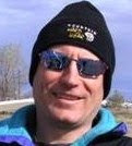
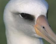
Alby flight No. 3 - Peter Kelly, 11/4/2008
In the month of November it is unusual to have a good cross country soaring day in northern California, but this was only the first week of November, and a frontal passage had occurred overnight. Alby had taken a flight to the Pacific Ocean one day last month, but he was still awaiting for his first journey from Williams in the direction of the Atlantic Ocean. It would be my honor to claim Alby Pin #2, and I was hoping things might fall into place for me to win that prize.
Although I recognized that the Alby Flight was quite important, other matters needed to be attended to before I would be allowed to fly with Alby on Tuesday, November 4th, 2008.
This was the historic day on which Barack Obama would be elected president of the United States, thus it was urgently required that I cast my ballot. Voting was the highest priority of the day, even before Alby. The second challenge was to garner permission from the gliderport management to allow a special flight operation on a day on which the airport is closed.
By 9:30 AM voting had been accomplished, permission to operate had been received from the gliderport. In fact, a tow was graciously offered to me. Now for the final review of the weather, commute from home to the gliderport, assemble the glider and prepare for the flight.
I located my camera, loaded the flight computer, and insured that I would have a current Sectional Chart aboard the glider. Unfortunately, I did not mount the camera or preset the time date stamp, did not review my route of flight on the computer and did not prefold the Sectional chart before Takeoff. It was well past 1 PM before Alby was placed aboard my glider, and we finally prepared to hook up the tow rope.
With Alby aboard, I towed to the northwest of the field, insuring the Alby would not have the benefit of a tow even for a small portion of his journey. It was important that all travel be conducted in free flight - on the wing - sans any propulsion systems.
Our progress was being published every ten minutes on the internet using the satellite messenger system - SPOT, and I was sure we had many Alby fans cheering us on. I took many photos during our journey, documenting nearly every cloud. The day looked very promising.
Alby and I were quite optimistic as we headed past Dunnigan, but we knew we should have launched much earlier. Conditions were there an hour earlier, but I wasn't ready to fly, and I couldn't take any chances with my precious cargo aboard.
I could not establish radio contact with the gliderport, but I transmitted in the blind at 5,000 near the I-505 intersection. That must have been garbled when being received at WSC.
My max height for the day was there at 5/505 and it was about 6,000 ft.
Expecting to pass directly over Travis AFB and probably at a low altitude, it was important that I requested flight following from the Air Traffic Control agencies. I tuned the radio to NorCal, who handed me off to Travis Approach - North Sector. Approaching Vacaville, we were handed off to the South Sector. As we glided over I-80 and then above the towers at Lagoon Valley, we were now down to 2,000 feet. Finding a nice thermal on the downwind side of the ring of hills we climbed up to 5,000 feet as we drifted into the class D airspace of Travis, with their full permission. Remaining well below the nice cloud street heading off towards the south of Stockton, we crossed overhead Travis and as we did so, I struggled with folding and refolding the Sectional Chart. As we approached Rio Vista at about 3,000 ft. I terminated the radar flight following in hopes I could salvage my glide to Byron, I was so close, but I had failed to establish a glide to the field.
At this point I considered going back to the northwest and do a climb to 5,000 for a glide through the blue air to Byron but Alby deserves better than just barely making the runway. I tried to continue to run the clouds and was planning on an approach to Byron from the east, but I never got the needed climb.
We drifted south, under cloud remnants, but all the while, sinking lower and lower. I was staying within glide of a duster strip about 6 miles to the East of Byron when I finally fired up the iron thermal. Alby had been encouraging me to not stretch the glide, so back to Williams we went. I made a video of our landing at Williams and placed it on YouTube. you can see there were still lingering cloud remnants - even at 20 minutes before sunset. see YouTube video at...
http://www.youtube.com/watch?v=TSTPZj60eoM
It was a good day. Alby is now resting comfortably at Williams, awaiting his next adventure.
View flight on OLC
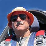
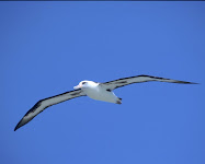
Alby flight No. 2 and pin No. 1 – Sergio Colacevich, 10/11/2008
Oh what a great flight, for Alby and for myself: Alby flew over the ocean and I did an unusual and difficult flight. It happened on the Saturday that was Octoberfest in Williams, but the weather that day was not the most desirable for the event: There was a strong north-northeast wind that had discouraged many pilots. At the morning briefings only half a dozen of pilots were present. The forecast was similar to yesterday’s, with strong winds from the north all over California. Yesterday the forecast was for 25 to 30 knots wind, some clouds with high bases (10,000’ to 11,000’) near the coast, a critical height of 7,000’ and a top height of 9,000’. That was a very unexpected forecast: why, with a north wind, would the lift go that high?
But in the afternoon from my office I could see the far away clouds so I believed the forecast was accurate. For the past few weeks I had focused on taking Alby to Byron and looking at the long way out I would have to use in Friday and realizing it would take me close to the coast at high altitude, the thought sprung out that in a day like this I could have taken Alby to the ocean. One of the things that I really wanted to begin Alby’s voyage was to take him over the Pacific waters, and eventually it will have to be done over the Atlantic waters too. So originally the plan was to take Alby to Hollister, much closer to the ocean than we are in Williams, and there Ramy would take care of doing the flight or having somebody do it. So I had the dismay feeling that I missed a good, albeit unexpected, occasion to do a very fitting flight, innovative and especially fitting to Alby (it is not easy at all to reach the ocean even from Hollister, although it is nearer).
On Friday evening the forecast for Saturday was similar but not as favorable: yes there was a band of high lift close to the coast, but lower than yesterday reaching 8,000’, and no clouds. There was a band of poorer heights (6,000’) in the interior, that had to be crossed. Thermal strength was about 5 knots versus yesterday’s 6. And the winds were still strong, although a little less at 25 knots. Still heavy with the disillusion of having missed yesterday’s occasion, I commit myself to try the flight anyway; you never know what happens until you are there.
I start at 11:48 after Luke who evidently took the first lift he found and missed it, and was coming back to landing. We find a couple of lifting areas on the way but I resist until we are downwind of the ridge that goes to the Tree Farm. From release altitude at 6,000’ we circle to about 9,000’ being drifted downwind about 3 miles by a 21 knots wind. One mile away I could see Luke, who meanwhile had taken another tow, just going straight upwind and climbing. The lift is very smooth although weak at 2 knots and we both think it is wave, although it is unusual to climb going upwind for such a long stretch rather than across the wind. However, it is parallel to the lesser ranges bordering the San Joaquin Valley.
Reaching 9,000’ I move along the ridge in the direction of the Tree Farm, but the lift is not there. Sink begins. I move swiftly towards the backside of Goat Mountain, but I find no wave there. We are losing altitude rapidly and we turn back promptly. Unrelenting sink forces us back towards the area where I found lift before, which we reach at 4,500’, while Luke says he is at 12,000’ above us now.
Down here I sense some lift and scratch around for 15 minutes before finding one knot, than two. But it becomes better and better until we are going up with 5 knots in the averager and for a couple of minutes with 6 knots. At 13,000’ the lift ends and I begin to move west. The evening before I had studied different scenarios, like going to Ukiah or things like that but in the actual situation I regress to familiar routes, directing towards Mt. Saint Helena to look for wave there. I have the McCready at 1 knot and my speed over the ground is pretty swift. But it does not work as expected. I am finding continued sink. I find a bit of lift in front of Mt. Konocti but not in the back of it, same for Mt. Cobb. At Mt. St Helena too, there is some poor lift upwind, but sink downwind. Over the middle of the Calistoga Valley I find a little thermal which takes us back to 8,500’, and so encouraged I continue west.
I am in unknown territory now. In the morning I had placed in the GPS the airport of Healdsburg, and that is my only reference around here. I am still high at almost 7,000’ and still checking my glide to Healdsburg when I stop in a thermal and with big surprise I find out I am above a majestic airport, with two runways angled in a “V” shape. It is the Sonoma County airport. That’s a good new. Now the coast is about 20 miles away and really tempting. I force myself to still look for areas of possible lift, and I find one that takes us slowly to 7,500’. This should be reassuring in most circumstances but still I do not trust the incomprehensible features of the day. I have been twice today in strong unrelenting sink without finding a way out until the sink stopped without apparent reasons.
I do the last 8 miles to the coast still apprehensive about the altitude, and I go over the ocean for only a half a mile or so. The ocean is a beautiful sight, with the strong winds producing foaming waves that run parallel to the coast. I notice how the wind on the ocean is converging towards the coast while the winds on the land are going towards the ocean, albeit at a shallow angle. There might possibly be some lift generated somewhere where the winds meet but I do not find trace of it. As it so happens, we are north of Bodega Bay and just south of the Russian River, and I recognize the places where I visited with my wife time ago.
I go back to the last thermal and nearby I find another one that takes us back to 7,000’. Of course the next step is to look for the Sonoma airport where I found that nice thermal before and I find it again and climb to 8,ooo’. This is encouraging. I would be happy landing here but I can try to go to Crazy Creek. We direct more or less upwind. To the north of Mt. Saint Helena I find enough lift to get in glide to Crazy Creek, which I reach shortly thereafter. Of course the going is slow with such a headwind, but near the coast had been benign, about 12 knots, and I even found 8 knots. Just on top of the Crazy Creek airstrip I find good wide lift that takes us to 8,000’ where I read 16 knots wind. Notwithstanding the wind I have Charters just exactly in glide. Let’s see what happens now.
I direct more or less towards the Three Sisters that I can recognize from here. Immediately I find some sink, which once again does not stop but continues unabated. I have –2, -3 in the “Netto” which translates to –4, -5 actual sink. We are losing altitude desperately and quickly. Charters is no more in glide but I am proceeding just waiting for some lift to appear, with an eye on my glide to Crazy Creek. All of a sudden I realize that if I go back I have to pass trough the same sink I just encountered. I check the computer: I have 1,500’ above glide for Crazy Creek, and I turn back immediately.
Of course I am taking a different route, more to the west and I find that the sink is milder here. I am going towards a knoll that in the past has been good producer of thermals. It works, and I go up to 7300’ before the lift peters out. While climbing I had decided to go straight upwind, because this is what seems to work today. I take aim at the knoll (we have drifted 4 miles) look far away to a reference point and find us directed to a point west of the Walker Ridge. By coincidence, it looks we are directing straight to the place where we have found the wave at the beginning of the flight. I take it as a good omen and go, thinking that if I cannot make it now, I will land back in Crazy Creek and get a retrieve.
But it works great. I find much-reduced sink and some bumps of lift. I move the McCready to find the best speed to fly and find out that if I set it at 1,5 knots; I can reach Charters at the highest possible altitude. I am 1000’ below glide for Charters but in glide for Crazy Creek so I continue until, I find lift! Yes it takes us back 2 miles but it takes us from 5,500’ to 7,600’ and now I have more than a thousand feet above glide for Williams! I feel totally relieved. Without this last thermal, the flight would probably end at Crazy Creek.
On the long final glide I also take full realization of the clarity of the atmosphere today. At all times during the flight I could see far and clear, from Williams to the coastline. The computer makes us point the glider nose about 30 degrees to the north of the direction for Williams, because now the wind has come back to about 20 knots from my left.
The last episode of the retreat to Crazy Creek, the milder sink on a different route, and similar findings coming back from the coast makes me realize that today we did not have wave at all. When you go cross-country in wave, you find alternate bands of lift and sink oriented across the wind. Today, the bands were oriented along the wind. That is why at the Farm Tree we stayed in the lift going directly upwind. It may happen that we have large bands of lift in wave days, but not this large; and we have sink before and after the lift, which we did not have today. The lift at the Farm Tree was so smooth that it really resembled wave, but it was not: It was a convergence line. The whole day we passed through sinking and lifting convergence lines and I never realized it until now. The main reason why we thought it was wave is because the lift was so smooth, smooth like a wave.
I have seen this phenomenon in Texas in some days: clouds form in the early morning with bases of less than 1,000’ and organize in parallel cylindrical rolls oriented with the wind, spaced 1 mile or so. The rolls extend to the visible horizon, you can see the clouds moving downwind and you can see the internal movement of the roll, lifting in the middle and cascading on both sides. The formation continues until mid morning increasing rapidly in altitude until the pattern disappears in the general turbulence of the summer day convection.
On the ground I feel triumphant, elated like at my first flights many years ago: Alby has now made his flight over the Ocean, his Voyage has started. I do not think anybody has ever done a flight like this from Williams: normally it is impossible to do it, and on the rare day it is possible to do it, nobody does it because there is no special reason to do it. But we (Alby and I) had a reason and we did it, no matter how unlikely it was at the beginning of the day. At dinner one of the presents tells me that a curious thing happened about ten years ago. An albatross was found, apparently lost, just there at Bodega Bay. It was named “The Lost Albatross”, and it made the news for one week, after which it took flight and disappeared.
What a parallel with Alby’s story and what a fitting coincidence. Sometimes reality is more fantastic than fantasy.
View flight on OLC
Alby flight No. 1 – Sergio Colacevich, 11/5/2008
The first cold front of fall 2008 in California was forecast just before the weekend of October 4/5. The forecast was for rain in Saturday and north wind in Sunday. Close following of Dr. Jack weather promised gloomy weather in Saturday and stronger weather for Sunday, albeit with strong wind. This forecast changed slowly to a showery day for Saturday and lesser height and wind strength for Sunday. So it was chosen to fly in Sunday. As it happened, Saturday began with complete cloud cover and drizzle, and changed to low cumulus all over the area. Was it possible to do the flight in Saturday? I will never know, but the clouds looked weak and not that high in Sacramento. Sunday morning the forecast was for practically no wind, no clouds, weak lift and low altitude, all different from the forecast of the day before. Trying it anyway I was able to take off at 1:10 PM, directing to phantoms of clouds over the ridge, south of the Three Sisters. Releasing at 4500’ and in the direction of Byron, I already had broken two rules, which had now to be exempted in the name of “special circumstances”. Reaching the first cloud, finding no lift and continuing south, slowly passed underneath everything resembling a cloud and descending up the Rumsey Gap, where I had to decide if to go back to Williams or continue. I chose to take Capay Valley as safety airport and continued towards the hills to the east of the valley, which sported better-looking clouds. Here again found nothing and begun to search for the location of the Capay strip (after discovering that I did not have it in the computer).
Suddenly, Oops! A bump and some lift and I began to circle, and after a couple of minutes we were climbing in 2 knots lift. Reaching 5,000’ I moved towards the main ridge, then south down to the last clouds, then beyond, then studied the situation. There were no clouds along the ridge, apart from some weak puffs. It was already past 2:00 PM. I just had a save, the lift was weak, and all appearances were that I could not continue. The flight was not clean because of the two broken rules. So I came back. Actually under the clouds there was some lift, two knots but at times 3 and even 4 knots. Cautiously I crossed towards Crazy Creek, then back, then towards Goat Mountain. The cloud base was just at the height of the mountain, so I had to go around Goat to go back to Williams.
There were maybe a half dozen of pilots flying. They stayed in the valley near Williams, between 2,000’ and 3,000’. Nobody thought to go to the hills.
In a day like that, I was lucky to be able to show Alby the place where we fly and felt grateful to the Weather Gods. It may seem silly to fly with Alby in a box in the back of the glider and talk mentally to him but as you know, this is more than a sport; it has a high spiritual content. My personal experience stays with me but laying it down in writing is transferred to other pilots who understand what I feel, because they have experienced it themselves. This is a celebration of the type of flying we do and so important for our souls, an endeavor, which takes us out of the everyday life in a world of our own. They are just emotions, not important in some ways, so much important in some other ways.
View flight on OLC
Subscribe to:
Posts (Atom)
Tracking the flights with SPOT

Where in the world is Alby?
Scroll below to follow Alby flying in real time. For more detailed information on the flight go to our Spot satellite tracking page.
Position updates are broadcast in real time every 10 minutes, although occasionally there may be delays. If Alby is not flying at this time, the trace shows Alby's most recent flight. Traces are left posted for the duration of one week only. However, the flight can be seen on OLC.


.jpg)
.jpg)
.jpg)
.jpg)
.jpg)
.jpg)

.jpg)
.jpg)
.jpg)
.jpg)
.jpg)
.JPG)
.jpg)
.jpg)

.jpg)
.JPG)